Banff National Park is one of the most stunning national parks in North America. Located just west of Calgary, this park highlights the best of the Canadian Rockies with its towering mountains, glacier fed lakes and rivers, and gorgeous canyons. In the world of hiking trails, I usually find the most beautiful trails are the most difficult to trek. However, there are several easy hikes in Banff National Park that are worthy being called the best hikes in Banff due to their stunning beauty.
Disclaimer: This post may contain affiliate links so if you make a purchase or booking through one of our links we might earn a small commission (but don’t worry, it’s no extra cost to you).
Where are the Easy Hikes in Banff
Canada National Park Pass
You are required to buy a Canadian National Park Pass when visiting the Canadian Rockies. You do not need to buy a separate pass for each park. Park passes can be purchased online prior to arrival or at the park entrance. If you buy your pass prior to arrival, allow ample time before you begin your Banff itinerary for the pass to be delivered to you. Make sure your pass is clearly displayed on the windshield of your vehicle to avoid being ticketed.
Bear Safety
Anytime visiting this area, but especially in the active Spring season, take extra precautions when hiking in remote areas. Odds are you will not use it, but it is a good idea to carry bear spray on hikes. Bears usually only attack when they are startled or protecting their young. If you tie bells to your pack or yell out occasionally, bears will most likely move away from the area.
Go Early! Be Early!
I cannot stress enough how important it is to start your day early. Even in the less busy shoulder months, the parking lots can fill up and the trails become packed with people. If that means you have to end the days early in your Banff itinerary, it will be worth it. Trust me!
What to Pack
- Water!! Whether you use a hydration backpack or carry bottled water, make sure to pack plenty of water when outdoors!
- Bug Spray – Keep those pesky bugs away!
- Sunscreen – Protect your skin from the sun, and do not forget to reapply.
- Hat – More sun protection to block the sun from your face
- Hiking shoes/boots – Here are the men‘s version of the hiking shoes I love.
- Hiking socks – The best way to prevent blisters is by keeping your feet dry. Moisture-wicking socks are the best way to do that.
- Backpack – A backpack is a necessity when hiking to carry your water, snacks, sunscreen, etc. that you may need on your longer hikes.
- Hiking Poles – Hiking poles help relieve some of the energy used by your legs when hiking.
- RTIC Soft-Sided Cooler – Keep your drinks and sandwich stuff cool in this cooler.
- Packing Cubes – Keep your stuff organized in your luggage with these packing cubes.
- Rain Jacket – Rain can (and probably will) occur at some point while in Washington, so make sure to pack your men’s or women’s rain jacket.
- Jacket – Even in warmer months, the temps can be cool so pack a light men’s or women’s jacket.
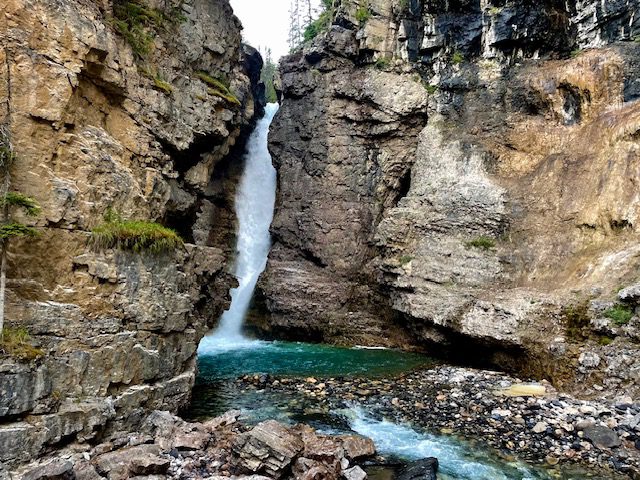
1. Johnston Canyon to Upper Falls
- Trail Length – 3.3 miles (5.3 km)
- Elevation Gain – 862 feet (263 m)
- Route Type – Out and back
Johnston Canyon is the most unique easy hike in Banff because the trail travels along the side of the canyon walls that have been carved out by Johnston Creek. The Lower Falls are located about 0.5 mile into the trail and can be seen from a viewing bridge and close-up through a small cave to a hidden viewing area. The spray at this viewing area can be severe so plan on getting a little damp. The Upper Falls mark the beginning of the canyon and can be seen from lower and upper viewing platforms. Watch the dramatic waterfall as it plunges 100 feet into the creek below.
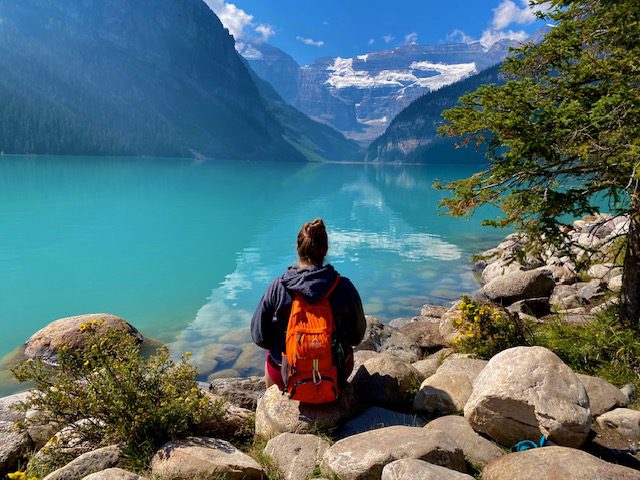
2. Lake Louise Lakeshore
- Trail Length – 2.8 miles (4.5 km)
- Elevation Gain – 354 feet (108 m)
- Route Type – Out and back
Lake Louise Lakeshore is one of the many easy hikes in Banff that circles a stunning sapphire lake. This one may be the most popular too. You can still park at this lake, but it is extremely crowded. The congestion may not be trying to park yourself, and you may want to take the shuttle here. The Fairmont Chateaux is a charming hotel at the lake’s shore that looks like a giant castle.
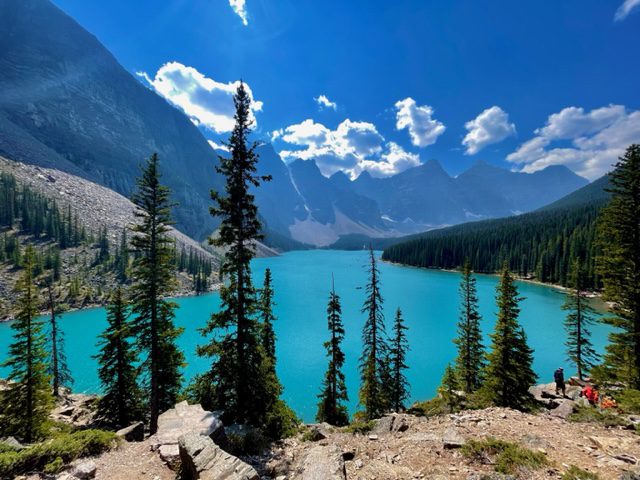
3. Lake Moraine Rockpile
- Trail Length – 0.5 miles (0.8 km)
- Elevation Gain – 32 feet (10 m)
- Route Type – Out and back
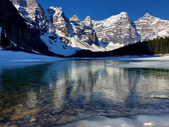
When you arrive at Lake Moraine, walk up the Rockpile Trail at the head of the lake. Atop the rockpile, observe elevated views of the half-frozen lake flanked by mountains. The lake was beautiful and was just thawing out for the summer, so we did not see the iconic green color that is typical for this lake and Lake Louise. A giant rock sat beside the trail path at the top of the pile that we climbed for a cool photo opportunity. You can no longer park at Moraine Lake, so you will need to take the shuttle.
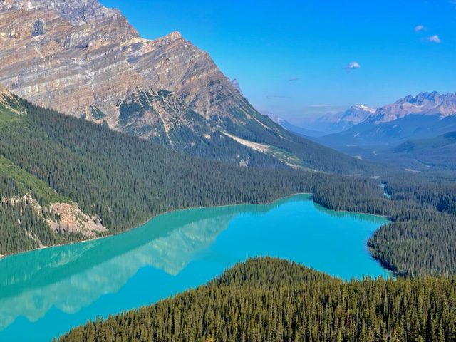
4. Peyto Lake Panorama Viewpoint
- Trail Length – 1.5 miles (2.4 km)
- Elevation Gain – 324 feet (99 m)
- Route Type – Loop
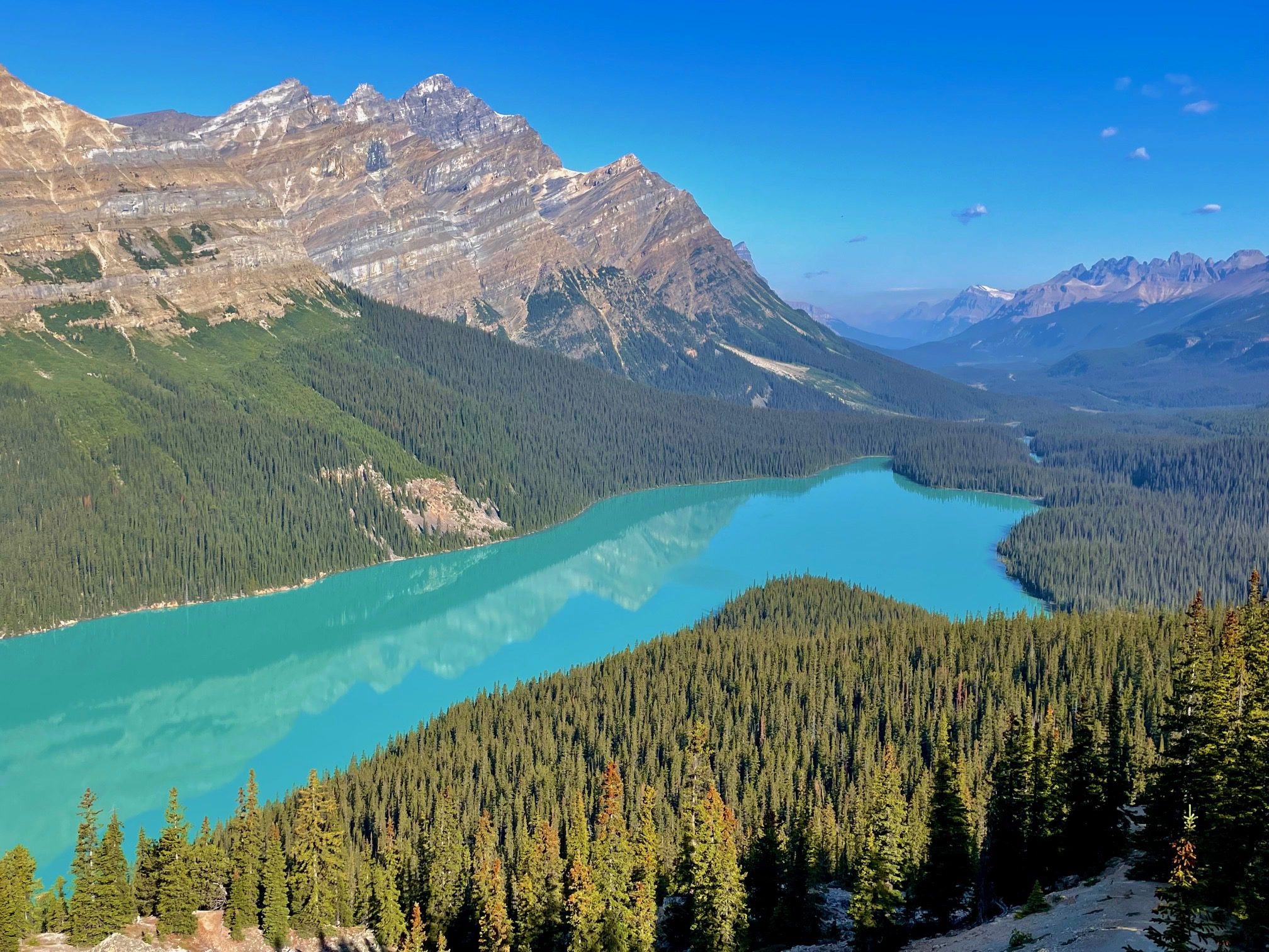
Peyto Lake Panorama Viewpoint is a 1.5 miles and one of the easy hikes in Banff. There is a shorter 0.8 mile that only goes to the first viewpoint, but the full loop is worth the other two viewpoints. During late July and August with the sun shining, Peyto Lake appears to be a cloudy, light blue hue.
5. Moraine Lake Shoreline Trail
- Trail Length – 3.2 miles (5.1 km)
- Elevation Gain – 902 feet (275 m)
- Route Type – Out and back
Moraine Lake Shoreline Trail is one of the most gorgeous of the easy hikes in Banff. In the summer, Moraine Lake gets a beautiful blue color much like the other lakes in the Banff area. We came here in late Spring when the ice had just started thawing. We were able to walk out onto the ice at the shoreline.
6. Parker Ridge
- Trail Length – 4.0 miles (6.4 km)
- Elevation Gain – 1,108 feet (338)
- Route Type – Out and back
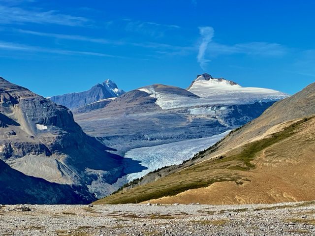
Parker Ridge is one of the easy hikes in Banff that is on the famous Icefields Parkway scenic drive. This trail leads you to great views of Saskatchewan Glacier which is actually only 3.4 miles roundtrip. The extra 0.6 miles is when you take a spur that leads to a 360 view of Parker Ridge. Even though there is 1,100 feet of elevation gain, the switchbacks make this a steady incline. However, this is probably the hardest of the “easy” hikes listed here.
7. Stewart Canyon Trail
- Trail Length – 4.2 miles (6.8 km)
- Elevation Gain – 862 feet (263 m)
- Route Type – Out and back
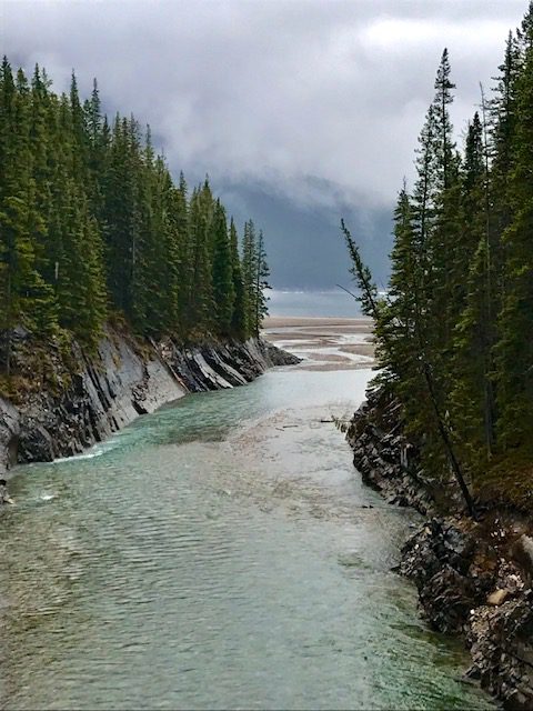
Stewart Canyon Trail is one of the easy hikes in Banff that is on the longer distance side than the others on the list. The hike starts off walking along the shoreline of Lake Minnewanka, and then crosses a bridge over Stewart Canyon. The trail then walks along the canyon for a bit. If you want to cut the hiking distance in half, then you can turn around at the bridge. The area past the bridge was closed when we hikes this trail due to longhorn sheep birthing season. We also were surprised by a giant black bear on this, so make sure to carry bear spray. This area is less traveled than other trails making the wildlife more abundant.
8. Johnson Lake
- Trail Length – 1.8 miles (2.9 km)
- Elevation Gain – 226 feet (69 m)
- Route Type – Loop
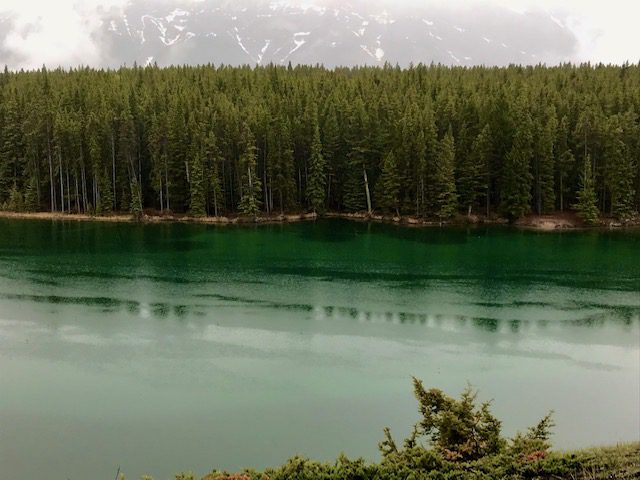
Johnson Lake Loop is another one of the easy hikes in Banff National Park not far from Lake Minnewanka. This area is also prone to be closed in the Spring due to the birthing season of longhorn sheep. We saw lots of deer while walking on this trail.
EASY HIKES NEAR BANFF
The remaining trails on the Easy Hikes in Banff list are not technically in Banff National Park, but they are close enough and are worth a little extra commute.
9. Marble Canyon
- Trail Length – 0.9 miles (1.4 km)
- Elevation Gain – 180 feet (55 m)
- Route Type – Out and back
- Location – Kootenay National Park
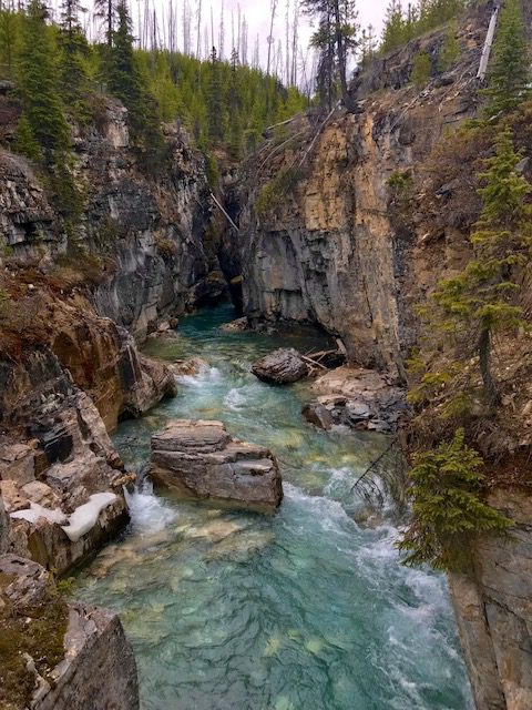
From the parking lot, you walk across the creek and begin the less than 1-mile roundtrip hike along Tokumm Creek. The color of the water was a stunning glacier blue, and the canyon walls were a dark gray marble. This trail was picturesque walking along the canyon wall edges with several bridges that crossed over the canyon for amazing top-down views of the creek.
10. Paint Pots
- Trail Length – 1.3 miles (2.1 km)
- Elevation Gain – 193 feet (59 m)
- Route Type – Out and back
- Location – Kootenay National Park
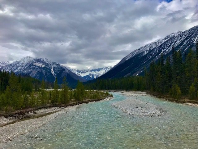
The Paint Pots trail in Kootenay National Park is an easy 1.2-mile roundtrip hike that leads to colorful spring-fed pools. However, the journey to the pots is much more impressive than the pots themselves. After a short downhill walk from the parking lot, you come to the Vermilion River surrounded by snow-covered mountains. Continue the hike over a wooden bridge and then to the left.
11. Wapta Falls
- Trail Length – 3.0 miles (4.8 km)
- Elevation Gain – 410 feet (125 m)
- Route Type – Out and back
- Location – Yoho National Park
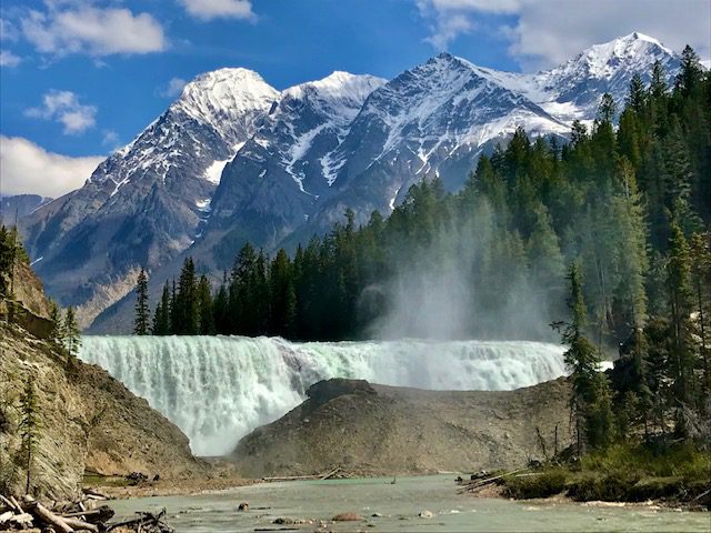
If you are using Google Maps, enter Wapta Falls Main Trail as your destination, not just Wapta Falls. If you do, it will take you 10 minutes past the unnamed road. The trail is an easy 3-mile, out and back, path that is relatively flat until you approach the Wapta Falls Overlook where the trail begins to climb. The once faint sound of a waterfall gets louder and louder until go up and over the mountain peak where you see the massive waterfall below. A chain length fence runs alongside the edge of the cliff for safety. A huge hill sits at the bottom of the Wapta Falls which diverts the Kicking Horse River to the left.
12. Emerald Lake Loop
- Trail Length – 3.2 miles (5.1 km)
- Elevation Gain – 400 feet (122 m)
- Route Type – Loop
- Location – Yoho National Park
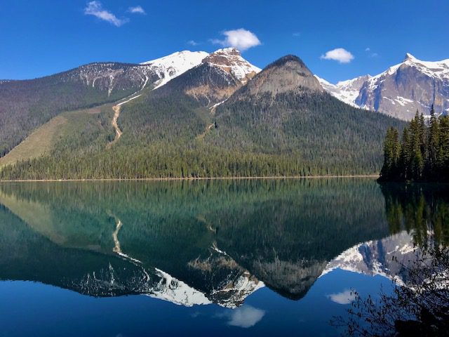
Emerald Lake Loop is a pristine lake that you can stroll around the lakeshore for easy hikes in Banff area. We walked this trail clockwise, and it ended with a walk through the cabins of the Emerald Lake Lodge. These cabins were peaceful and offered full views of the lake. By the late morning hours, people will begin rowing canoes in the lake. If you want to get pictures of a still lake to get reflections, get here before the canoers disrupt the water.
13. Takakkaw Falls
- Trail Length – 1.1 miles (1.8 km)
- Elevation Gain – 255 feet (78 m)
- Route Type – Out and back
- Location – Yoho National Park
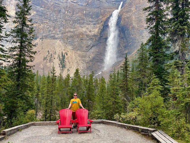
Unfortunately, I was unable to hike this trail when I visited Banff because the trail was still close due to heavy snow. It is one of the few easy hikes in Banff with a waterfall feature. The waterfall is 1,224 feet (373 meters) tall making it the second tallest in Canada.
14. Natural Bridge over Kicking Horse River
- Trail Length – 0.1 miles (0.2 km)
- Elevation Gain – 10 feet (3 m)
- Route Type – Out and back
- Location – Yoho National Park
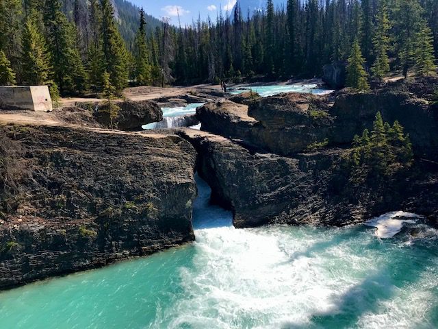
The Natural Bridge over Kicking Horse River is a pullout near Emerald Lake Loop. You can cross a man-made foot bridge just down river of the Natural Bridge for views of the rock formation. This was once a waterfall, but the earth eroded just before the rock formation from the rushing waters widening the rocks and sculpting an arch. Atop of the rock formation, you get an intimate view of the raging river crashing together and swirling down a bowl-like waterfall through the Natural Bridge.
15. Grassi Lakes
- Trail Length – 2.1 miles (3.4 km)
- Elevation Gain – 583 feet (178 m)
- Route Type – Loop
- Location – Canmore, Alberta
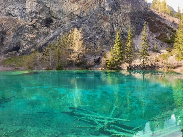
The 2-mile trail is a wide path is a uphill walk to the setting of two lakes that look like they are straight out of a fairytale. The two lakes are nestled together, one lake spilling into the other by way of cascading falls. The lakes are still and a pristine greenish-blue color that they look unreal. On one side of the lakes stood a towering rock formation where climbers can be seen scaling the steep wall.
You May Also Be Interested In
The Best Banff Itinerary for Spring and Early Summer
The 9 Best Easy Hikes in Jasper National Park
The Best of the Icefields Parkway Drive: How to Get from Banff to Jasper in One Day
Glacier National Park in Spring and Early Summer
How to Spend a Week in Washington State



1 Comment
Comments are closed.