A Columbia River Gorge adventure is a must do outdoor vacation for hiking enthusiasts. This was my first time to Oregon, and so far, it is my favorite state to visit in America. The lush, mossy forests, scenic mountaintop views, and majestic waterfalls make it a premiere place to witness nature’s beauty. My only regret is that we did not stay longer. But who knew this place was so beautiful? Here is how get the most out of Oregon’s Columbia River Gorge hikes.
Disclaimer: This post may contain affiliate links so if you make a purchase or booking through one of our links we might earn a small commission (but don’t worry, it’s no extra cost to you).

Free Columbia River Gorge Itinerary
It may take several minutes to show up in your Inbox.
NEW MULTNOMAH WATERFALL PERMIT REQUIRED
As of 2022, Multnomah Falls requires a timed entry permit between the end of May and beginning of September between 9am and 6pm daily. If you plan to visit during these times, you will need to get an access permit from recreation.gov prior to your visit. During my visit, I arrived extremely early in the morning since I did not obtain a permit prior to arrival, and I had no problems. You should arrive before 7:30 am if this is your plan. Another option would be to take the hop-on/hop-off Waterfall Trolley to avoid needing an access permit.
Weather
For our May trip the weather was cool, and it lightly rained most days. The temperature felt cooler than we planned for because of the water in the air, and we did not pack the appropriate clothing. We often found our clothes soaked from the rain which added to the chill. With that said, the Spring season is a great time to visit this area. The crowds are far less populated during this time. We often found ourselves alone on trails. Also, the snow is melting that results in full waterfalls and small streams cascading down the mountains and mossy cliffs.
Accommodations
We stayed at the Best Western Plus Columbia River Inn. This hotel was in a great location to minimize driving times. One day we were soaking wet from a rainstorm that hit while we were in the middle of a hike. We were able to make the 15 minute drive back to our hotel to change clothes and shoes before continuing our day. Also the hotel offers free breakfast from the restaurant, Bridgeside, that it shares a parking lot with. The breakfast was a buffet that had all the usual foods to help fuel us for our miles and miles of hiking. The Bridgeside restaurant was where we ate most of our dinners too. It was convenient and offered many food options.
Hiking Ability
My fitness level is that of an average person. I am not the type of person that wants to strap on an overnight pack and walk around mountains for days. Moreover, I like to do multiple day hikes with the longest hike being in the 5-6 mile range. I am usually good for 10-12 miles of trail walking per day. Then I like to sleep in a comfortable bed with all the amenities that a hotel offers. If this sounds like your ideal hiking trip, then this 3-day itinerary is for you. For more information on hike lengths and difficulty, visit All Trails.
What to Pack
- RTIC Soft-Sided Cooler – To save money on lunches, we bought sandwich stuff and drinks and carried them around in the RTIC Soft-Sided Cooler.
- Rain Jacket – We visited in the spring when rain is likely. Get your men’s and women’s rain jackets before you go!
- Baseball Cap – Whether you are protected your face from the sun or the rain, a cap is a must-have on outdoor vacations. (Men’s Baseball Cap)
- Sunscreen – Protect your skin from getting burned with sunscreen.
- Chapstick with SPF – The air is dry, and you will need to moisturize your lips with SPF chapstick.
- Bug Spray – Keep the bugs from annoying you on your Columbia River Gorge hikes.
- Backpack – Carry water, snacks, and other things you may need while on your Arizona road trip with a backpack.
- Hiking shoes/boots – Some of the hikes are on steep, slick rock, and people wearing regular tennis shoes struggled to keep their footing. Here are the men‘s version of the hiking shoes I love.
- Hiking socks – The best way to prevent blisters is by keeping your feet dry. Moisture-wicking socks are the best way to do that.
- Fleece Leggings – These fleece-lined leggings are super comfortable and will keep you warm. Also, they have pockets!
- Light Jackets – Even in warmer months, the weather can be cool. Make sure to pack a light men’s or women’s jacket to keep you warm.
- Water Shoes – When hiking the Oneonta Gorge, we changed into water shoes so we did not get our hiking shoes wet.
Arrival
We arrived in Portland, Oregon the night before Day 1 of hiking and stayed in a hotel near the airport. After collecting our luggage and renting a car, we stopped at a grocery store. We like to have bottled water, snacks, and sandwich stuff for our hiking vacations. Furthermore, we never know where we might be when we get hungry, and we are prepared with sandwiches in a cooler. Typically, we are not the kind of people that plan vacations around mealtime and specific restaurants to eat at. Also, it is important to stay hydrated, so we keep a case of bottled water in the car. Make sure to drink plenty of water even if you are hiking in cold weather. You do not get as hot and sweaty, so people tend to not drink enough.
DAY 1
We began driving toward the Columbia River Gorge area. After being on the road for about 20 minutes, you turn onto the Historic Columbia River Highway. There are several trailheads and waterfalls along the Historic Columbia River Highway. Highway 22 runs parallel to the Historic Columbia River Highway and alongside the Columbia River for through traffic.
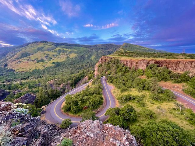
Portland Women’s Forum State Scenic Viewpoint
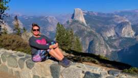
After driving on the Historic Columbia River Highway for approximately 3 miles, you come to the Portland Women’s Forum State Scenic Viewpoint. This is one of the best locations for panoramic views of the Columbia River Gorge with the Vista House off in the distance. Spend a few minutes here soaking the Oregon beauty.
Vista House
The Vista House was constructed on Crown Point in 1915 and offers majestic views of the Columbia River Gorge. We spent a few minutes walking around taking in all the beauty of the Columbia River in both directions. Inside the Vista House, we talked to a volunteer at the information desk who provided us with a trail map of the area. The Vista House also has a small, but cute gift shop. This is one of the few gift shops located in this area. If you are looking for a souvenir for completing these Columbia River Gorge hikes, here is a good place to buy one.
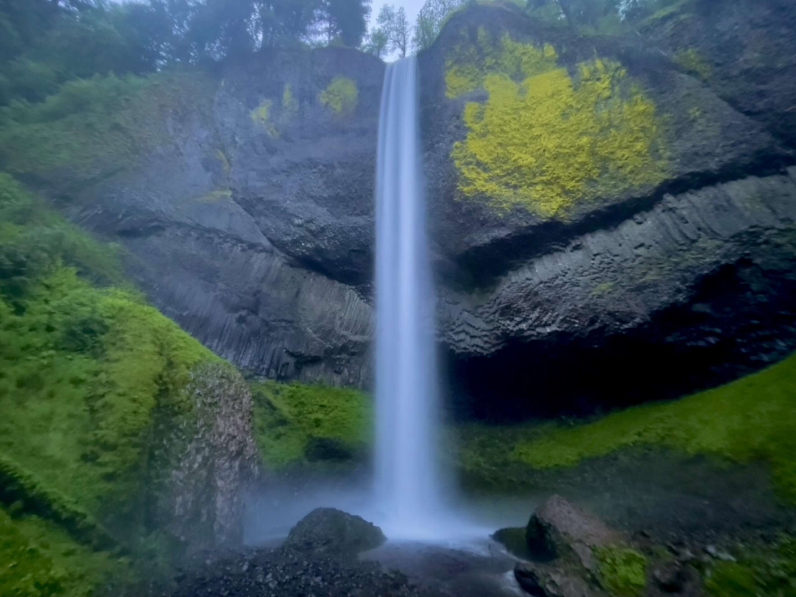
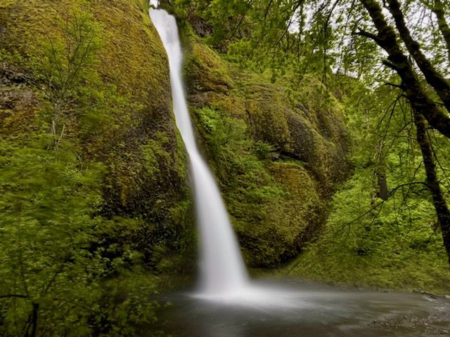
LaTourell Falls
About 2.5 miles east of the Vista House, we stopped at LaTourell Falls for our first hike. The hike is a 2-mile easy loop and is a good start for your Columbia River Gorge hikes adventure. Shortly after starting the hike, look to your right to see the bridge that you just crossed surrounded by green vegetation. You walk 0.7 miles downhill to LaTourell Falls by way of a natural staircase. The falls are tall and land in a pool that you can walk right up to. After admiring this waterfall, we decided to cut the hike short and head back to the parking lot instead of finishing the loop.
Bridal Veil Falls
Travel east 3 miles to reach the trailhead for Bridal Veil Falls. Our original plan was to stop at Multnomah Falls before Bridal Veil Falls, but the parking lot was full. We decided to go ahead to the next stop, and we came back to Multnomah Falls later in the day. Bridal Veil Falls Trail is a 1-mile, easy out and back hike to a platform with the perfect views of the falls. This trail was one of the more crowded of the trails. It was also one of the easiest walks with very little elevation change.
Oneonta Gorge
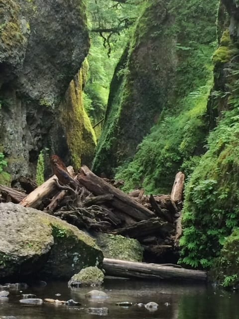
UPDATE: Oneonta Gorge is closed and will likely remain so until at least 2026.
Pictures from Oneonta Gorge flooded my Pinterest page and were the main reason I wanted visit the Columbia River Gorge hikes. The view of the moss-covered narrows towering above me with a creek at my feet is the most awe-inducing place I have ever seen with my own eyes. But to see it, you have to work for it. From Bridal Veil, we drove another 3 miles east to Oneonta Gorge. This trail is not marked very well. If you get to Horsetail Falls, you have gone too far.
Starting the Hike
Once you get to the parking lot, I advise you to change into water shoes or tennis shoes that you do not mind getting wet. The trail is literally a flowing creek. Depending on the time of year and the snow fall amount, the water can be chest high in some places. Also, I would not bring a backpack or anything unnecessary for this hike. The log jam is dangerous and difficult to climb and maneuver through. The less objects you have to cart around, the better. We ended up leaving our backpack with the expensive camera at the log jam because we could not handle carrying it. We did not make it to the end of this trail for fear of someone taking the backpack, so we turned back early.
After descending a few stairs, you walk on solid ground alongside the creek for a little bit, and then comes the time to cross the wide creek. There are several fallen logs that you can choose to walk across. I do not have great balance, but I managed to make it across. On the way back, when my shoes were soaking wet, I walked right through the water and did not try to balance on the logs again. My advice is to just walk through the water.

Traversing the Log Jam
Keep walking up the creek bed, and then you will come to the log jam! I knew there was a log jam from my pre-trip research, but I was not prepared to how large this log jam is. We had to climb up the gigantic boulder by wedging ourselves between the rock and the cliff, leveraging each to climb up. I also thought the climb would be simple up and over, and it was not. The log jam goes on for maybe 100 feet before it ends. Next, you will need to maneuver over and under logs like it is an obstacles course. I cannot stress enough to be very careful climbing over this log jam; it is extremely dangerous!
The view of the moss-covered cliffs is worth it! And this trail is an absolute must-do Columbia River Gorge hikes. After you have triumphed over the log jam, you have an easy walk up the creek to the Oneonta Falls.

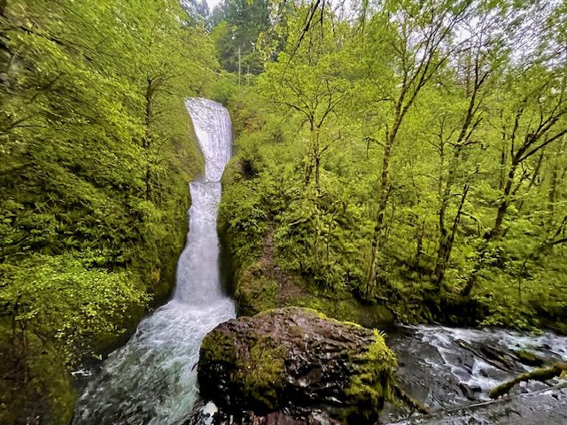
Multnomah Falls/Wahkeena Falls Trail Loop

We headed west (back the way we came) to arrive at Multnomah Falls and lucked into a parking spot. The parking area is small especially for the number of people that visit these falls. Multnomah Falls Lodge and Restaurant are near the parking area. The falls lie just behind the lodge, and there is a short walk to get to the Benson Bridge. Multnomah Falls is 620 feet tall and is the tallest waterfall in Oregon. We continued our hike up 1 mile of steep switchbacks to the top of the waterfall. Both the viewing area at the bottom of the falls and the hike to the top of the falls were littered with people. However, most people return down the 11 switchbacks. The total elevation change for this hike is almost 1,600 feet.

We decided to continue and complete the Wahkeena Falls Trail Loop, and we only came across a handful of people. The entire loop starting at Multnomah Falls Lodge is 4.9 miles and took almost 3 hours to complete. The trail starts ascending along the creek cascading down the mountainside over rocks and green vegetation. After passing Lower, Middle, and Upper Dutchmen Falls, Dutchmen Tunnel (an overhang created by creek washouts), Wiesendanger Falls, and Ecola Falls, you will then come to a junction. Turn right onto the Wahkeena Trail. Then you have about a mile left to hike before reaching the highest point of this loop.
After you reach this point, you will begin to walk across the mountain through a forest of tall trees. At this point a heavy rainstorm appeared and fog rolled in.

We continued our lateral walk across the mountain until we began to descend via switchbacks. Next, we passed Fairy Falls and Wahkeena Falls on the descent. We finished the loop walking alongside the highway back to the parking area at Multnomah Falls.

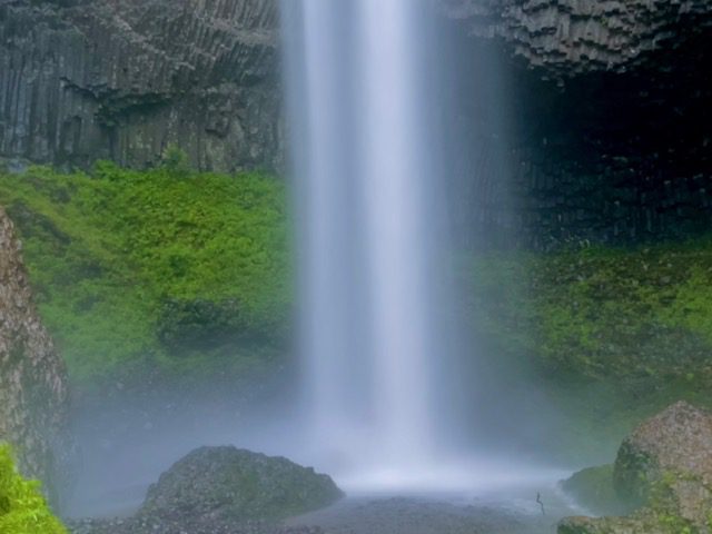
Horsetail and Ponytail Falls
Horsetail Falls is a short 3 mile drive from Multnomah and is right off the highway. After admiring this waterfall, you can start the 0.8 mile, out and back hike to Ponytail Falls. The elevation change for this hike is 260 feet. The best part of the Ponytail Falls is that you can walk behind the waterfall.
Our first day was magnificent and exhausting. After this last hike, we decided to check into our hotel, grab dinner next door, and go to sleep early.
DAY 2
Wahclella Falls
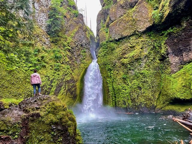
Wahclella Falls Trail is a 1.9 mile, out and back, easy trail with an elevation gain of 223 feet. The first part of this trail is a wide asphalt path along the Tonner Creek. The banks of the creek were bursting with colorful wildflowers.
Just before reaching the waterfall was a wide, flat area speckled with large boulders. A few groups of people congregated in this area for picnics and resting time. We moved past this area and headed to the waterfall. The Wahclella Falls is a powerful waterfall that empties into a pool. A man was wading in the pool about waist deep which led me to believe that this would be a good swimming hole for the summer months.
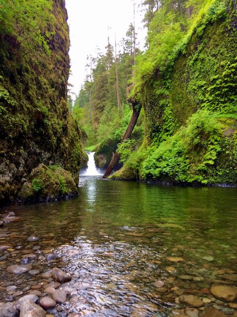
Eagle Creek Trail to Punch Bowl Falls


This hike is quite the adventure, but I would not recommend children attempt this hike. It is a 4.7 mile, out and back hike with an elevation change of 964 feet. The trail was blasted into the side of the cliffs. One side of the trail is a wall with ropes anchored into the rock to use as a handrail. The other side is a cliff that plunges deep into the gorge, but be careful on this part of the trail. If you fear heights, this is not the trail for you. As long as you are cautious, this trail is perfectly safe and offers a thrill.
The trail then begins to descend and at the end of the trail you will find a considerable opening with a rocky shoreline to a vast pool. Punch Bowl Falls sets up as the background to this large pool. For the best view of the falls, you will need to walk out in the water a bit. Luckily, there were rocks placed in the water by previous hikers that we could use as stepping stones.
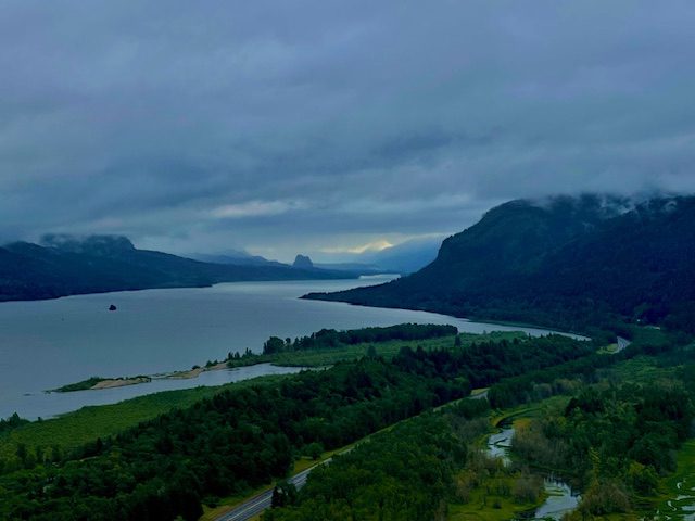
Rowena Crest Viewpoint
We were fairly exhausted from our hikes, so we decided to drive east along the river to the Rowena Crest Viewpoint. The drive takes about 45 minutes. Watch how the climate and geography gradually morphs from forested mountains to a rugged, desert-like terrain. At the top of the viewpoint, take in the magnificent views of the surrounding hills and the gorge below.
End your day by having dinner in Hood River and watching the windsurfers and kiteboarders crisscrossing through the river.
DAY 3
Hood River Fruit Loop
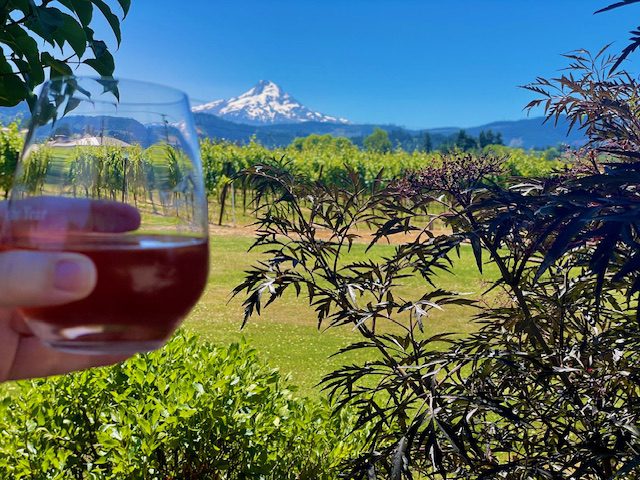
On Day 3, we drove the Hood River Fruit Loop with a detour to Mt. Hood. The Fruit Loop is a drivable loop near Hood River that features farms, orchards, road side fruit stands, and wineries. There are 26 possible stops. To find a map of these stops, click here. We did not visit all 26 stops. Instead we stopped at about 1/3 of the locations and added a trip to the top of Mt. Hood into the day’s activities.
We stopped at a few roadside stands and bought bread, cookies and jam. They were all delicious!
Mount Hood
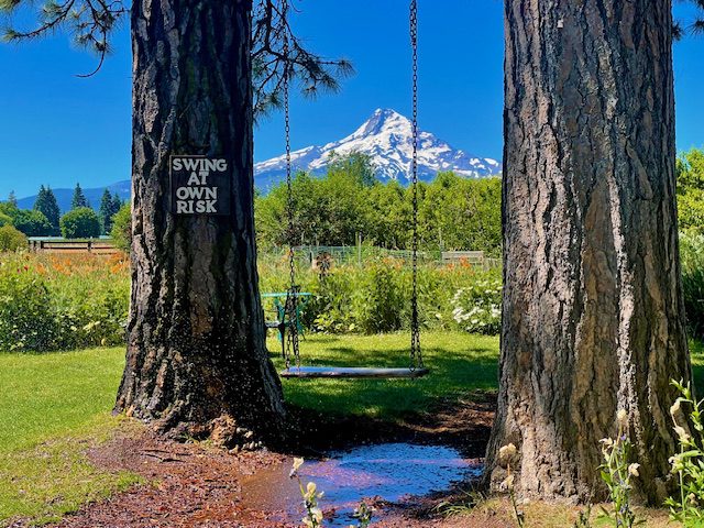
When we drive to the southern part of the loop, we kept going south on 35 instead of turning to the right. At this point, it is about a 45-minute drive to the Timberline Lodge and Ski Area at the top of Mt. Hood. As we arrived, a heavy snow storm developed, so we could not spend much time walking around and exploring the outdoor area. The ski lifts were open in May, so you could also spend a day skiing. After looking around Timberline Lodge a bit and warming up, we drove back towards Hood River to finish the west side of the Fruit Loop.
This concluded our epic 3-day adventure. If you loved the plunging waterfalls, lush forests, and beautiful scenic views, visit Oregon’s Columbia River Gorge hikes for one of the best outdoor locations in the U.S.

Visit alltrails.com for up-to-date statuses for trail conditions.
You May Also Be Interested In
The Best Hikes in Columbia River Gorge Oregon
How to Hike Oregon’s Trail of Ten Falls
How to Spend 3 Days on a Dreamy Oregon Coast Road Trip
The 18 Best Things to Do in Hood River, Oregon
How to Spend 3 Days in Olympic National Park
15 Thrilling Things to Do in Snoqualmie, Washington
