The Grand Circle Road Trip is a loop that covers some of the best Southwest America has to offer. Six national parks plus several national monuments and landmarks that highlight the iconic red rocks and sandstone landforms that have been carved out and formed from erosion, mostly due to the serpentine Colorado River. This part of the country is rather remarkable to explore. If you have two weeks of vacation to spare, the Grand Circle Road Trip is just that…GRAND!
Disclaimer: This post may contain affiliate links so if you make a purchase or booking through one of our links we might earn a small commission (but don’t worry, it’s no extra cost to you).
Free Grand Circle Road Trip – 14 Day Itinerary
May take several minutes to show up in your Inbox. Please be patient.
Where to Begin the Grand Circle Road Trip
Las Vegas is the best place to start the Grand Circle Road Trip for many reasons. First, it is the largest city on the loop so flying in and out will be quicker and cheaper than smaller regional airports. Also, you can extend your vacation and stay extra days in Sin City before or after your trip. Since this drive is a loop, you can choose to do this loop clockwise or counterclockwise. I opted to go counterclockwise just because I wanted to do the longer drives first. However, you can choose either way you prefer.
Itinerary Summary and Where to Stay Each Night
Obviously, you can customize your itinerary and where you stay each night based on your preference. I personally try to plan my trips so that I reduce the number of hotels I stay in, so I can stay in one hotel multiple nights, if possible.
| DAY | DAYTIME DESTINATION | WHERE TO HOTEL |
| 1 | Hoover Dam | Williams, AZ or Grand Canyon Lodge |
| 2 | Grand Canyon | Page, AZ |
| 3 | Page, AZ | Page, AZ |
| 4 | Monument Valley | Moab, UT |
| 5 | Canyonlands and Dead Horse Point | Moab, UT |
| 6 | Arches | Moab, UT |
| 7 | Capitol Reef | Torrey, UT |
| 8 | Grand Staircase-Escalante | Torrey, UT |
| 9 | Grand Staircase-Escalante | Torrey, UT |
| 10 | Bryce Canyon | Springdale, UT |
| 11 | Zion | Springdale, UT |
| 12 | Zion | Springdale, UT |
| 13 | Valley of Fire | Las Vegas, NV |
| 14 | Las Vegas | Las Vegas, NV |
Best Time to Visit the Grand Circle Road Trip
If you can avoid it, I would not drive the Grand Circle Road Trip June, July, or August because the summer temperatures can be scorching hot and the summer crowds can be rough. However, Bryce Canyon sits at an elevation of 8,000 – 9,000 feet and experiences much cooler temperatures than its other park counterparts. Typically the best times to experience Bryce Canyon is from May to September when the weather is warmer, but the crowds will be at much higher levels. Therefore, the best time to complete the Grand Circle Road Trip is April to May and September to early November for weather and crowd concerns.
Zion National Park uses a shuttle system for the Scenic Drive. This system is typically in place from mid-February through Thanksgiving and over the Christmas/New Year’s holidays. The shuttle system is very quick and easy to use, so I would not let it deter you from visiting when the shuttle is in operation.
Entrance Fees for the Grand Circle Road Trip
You will need to purchase a park pass to enter each of the national parks as well as day passes for Grand Staircase – Escalante National Monument. It is imperative that you purchase an America the Beautiful park pass, which will allow you into all national parks for a year for one single fee. If you paid for each park entrance fee separately, it would cost you $185. The American the Beautiful Interagency pass is $80 plus a $9 shipping fee. Also, if you have a 4th grader in your household, you can get a family pass for free to the national parks that is good for a year. Find out more about that benefit here.
Arches National Park requires a timed entry permit during certain times of the year between 7am and 4pm daily.
If you visit any state parks or participate in guided tours, these will be additional costs to the national park entry fees.
- Hoover Dam – Free to walk around, but a tour ranges from $10-$30 depending on the type of tour.
- Monument Valley – $8/person per day
- Horseshoe Bend – $10/vehicle parking fee
- Antelope Canyon – You must take a guided tour to see this canyon and ticket prices can vary. Click the link to see your options.
- Dead Horse Point State Park – $20/vehicle
- Valley of Fire State Park – $10/vehicle
What to Eat and Drink
As I do for many of my hiking vacations, I carry a soft RTIC cooler to keep sandwich stuff and drinks cold. Most of this Grand Circle Road Trip is in the middle of nowhere, so we prepared by having sandwiches handy for lunch time. Also, most of the restaurants are around are only open for breakfast and dinner. I recommend stopping at a grocery store in Las Vegas before the region gets too remote. Buy more water than you think you need if you are getting bottled water because it is hot and dry in the desert.
What to Pack for the Grand Circle Road Trip
- Water!! Whether you use a hydration backpack or carry bottled water, make sure to pack plenty of water when outdoors!
- Sunscreen – Protect your skin from the sun, and do not forget to reapply.
- Hat – More sun protection to block the sun from your face
- Hiking shoes/boots – Some of the hikes are on steep, slick rock, and people wearing regular tennis shoes struggled to keep their footing. Here are the men‘s version of the hiking shoes I love.
- Hiking socks – The best way to prevent blisters is by keeping your feet dry. Moisture-wicking socks are the best way to do that.
- Water Shoes – If you bring your own water shoes, you will not need to rent gear for The Narrows hike.
- Hiking Poles – Likewise, bring hiking poles for The Narrows hike to avoid having to rent gear.
- Backpack – A backpack is a necessity when hiking to carry your water, snacks, sunscreen, etc. that you may need on your longer hikes.
- RTIC Soft-Sided Cooler – Keep your drinks and sandwich stuff cool in this cooler.
- Packing Cubes – Keep your stuff organized in your luggage with these packing cubes.
- Jacket – Even in warmer months, the temps can be cool so pack a light men’s or women’s jacket.
- Printed Maps/Directions – Cell service is spotty, so I recommend you print maps/directions or download offline maps to all hiking trails and parks you plan to visit.
Day 1: Las Vegas to Hoover Dam
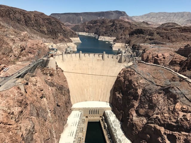
Whether you arrive in Las Vegas the night before or in the morning of the first day of this Grand Circle road trip, you will need to rent a car. After you load your luggage in the car, start your journey towards Hoover Dam. You can walk across the dam at no cost (except a parking fee if you park in the garage), but there is a cost for any tours you choose to do. After you are finished touring Hoover Dam, drive to the Mike O’Callaghan – Pat Tillman Memorial Bridge. Walk to the center of the bridge over the Colorado River and get incredible views of Hoover Dam holding back Lake Mead.
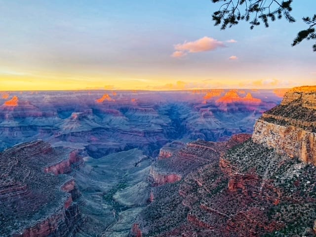
Finish your day by driving towards the Grand Canyon. You can either stay the night in Williams, AZ or inside Grand Canyon National Park. If you make it to the Grand Canyon this evening, make sure to watch the sunset. The colors of the canyon are spectacular as the sun sets.
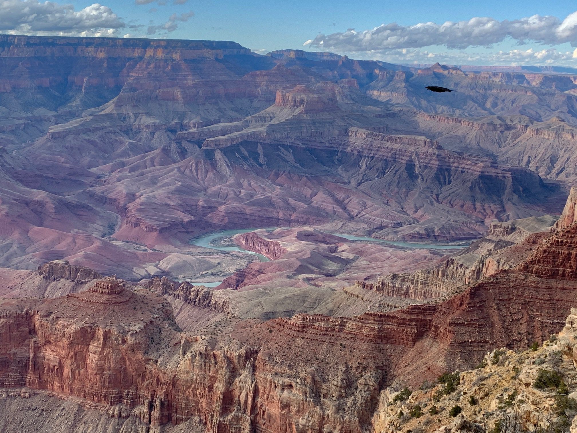
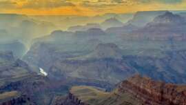
Day 2: Grand Canyon National Park
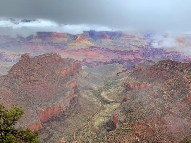
Spend the second day on the Grand Circle Road Trip exploring the Grand Canyon’s South Rim. From the Grand Canyon Visitor Center, walk along the South Rim Trail. Some notable viewpoints along this trail include Yavapai Point, Pipe Creek Vista, and Yaki Point. Once you have finished walking trails and shopping at gift shops, drive East on Desert View Road making stops at all the viewpoints until you exit the East Entrance. Finish the day by driving to Page, AZ.
Day 3: Page
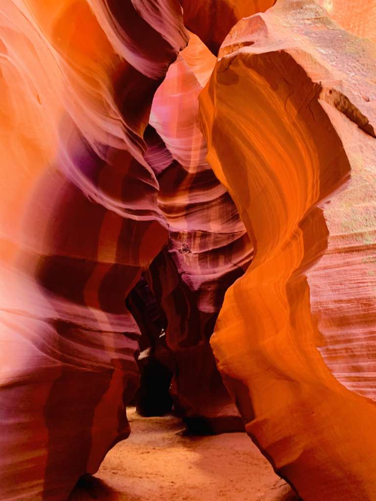
Page, Arizona is full of natural wonders. Your first to see is Antelope Canyon. Upper and Lower Antelope Canyon are slot canyons that have become increasingly popular. These canyons exist on the Navajo Reservation, and you must book a tour to gain access. Reservations sell out, so make sure you book ahead of time. Due to time constraints, we only visited the Upper Antelope Canyon which you enter at ground level. If you choose to visit Lower Antelope Canyon, you enter the canyon from the top and walk down stairs to get to the bottom.
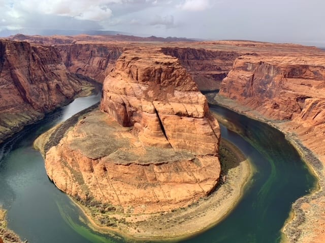
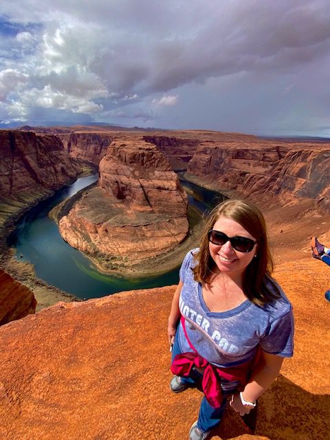
Horseshoe Bend is yet another amazing view that can be discovered in Arizona. The hike from the parking lot is an easy 1.5-mile, roundtrip stroll. At the end of your walk, see views of the dark green Colorado River 1,000 feet below you where it carved a 270-degree bend in the red canyon resembling a horseshoe. Check the Horseshoe Bend website for up-to-date entry fees, which are paid by vehicle type.
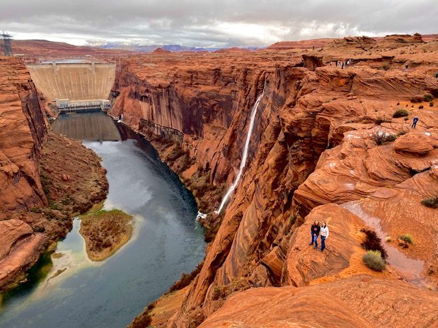
We spent a couple hours exploring Glen Canyon Dam Overlook area. There is no official trail here, just climb the red rock formations as long as you like. Walk onto the sculpted rust-colored sandstone to the canyon’s edge. See the Colorado River below you and Glen Canyon Dam just up river. Glen Canyon Dam created Lake Powell, one of the largest man-made reservoirs in the U.S. In the summertime, Lake Powell offers various summer recreational activities.
If you have extra time (or an extra day), you can check out the nearby Vermilion Cliffs National Monument. There are several amazing hikes in this park including The Wave, which is a trail so elusive you must win a lottery to get a permit to hike here. If you are lucky enough to win the lottery, you should definitely add a day to your Grand Circle Road Trip, so you have time to hike this 6.9 mile trail.
Day 4: Monument Valley
On Day 4, you will be driving a large chunk of the Grand Circle Road Trip to get to Moab, Utah. A nice stop about halfway to Moab is Monument Valley. The landscape is speckled with tall red rock formations that can be marveled at from the 17-mile driving loop on Navajo Nation lands. Wind and water have eroded this land over the last 50 million years creating what you see today.
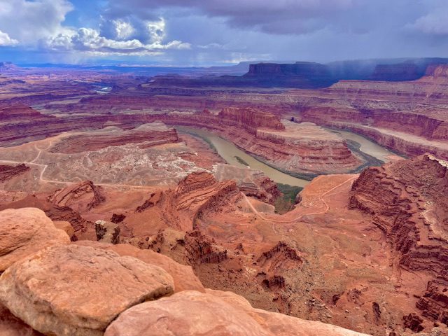
Day 5: Canyonlands and Dead Horse
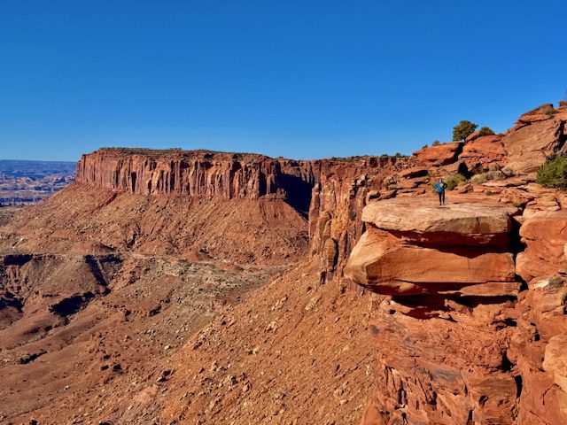
Our first stop was the Grand View Point Trail, which is an easy 1.8-mile hike beside a canyon wall. This hike offers views of the incredibly deep canyons below. On a clear day, you can see canyons for miles and miles with a beautiful backdrop of the La Sal Mountains.
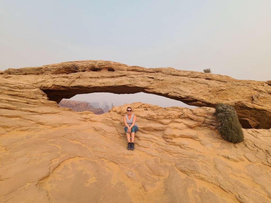
Our next stop was the Green River scenic overlook before continuing our to the iconic Mesa Arch. The hike to this arch is a short, easy 0.5-mile loop. This hike is very popular, so you may have to wait your turn for a picture opportunity. After you finish discovering Canyonlands, head to Dead Horse Point State Park for more views of amazing canyons.
Day 6: Arches National Park
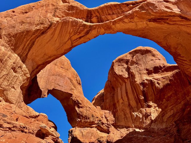
On Day 6 of your Grand Circle Road Trip, you will be visiting Arches National Park which is full of…you guessed it…arches! This park gets extremely busy year round. I often get alerts that the park has closed the entrance by 9:00 am even during less busy seasons. If there is one day that you wake up earlier than normal, this is that day.
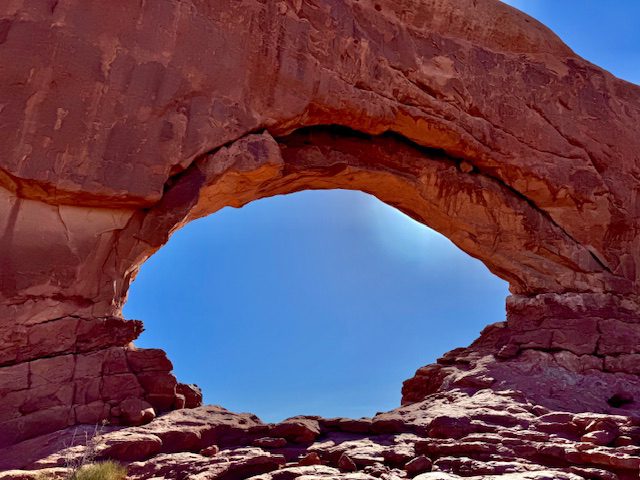
There are numerous hikes of varying degrees of difficulty and trail length in this park that you can choose from. We elected to hike Windows Loop and Turret Trail (1.2 miles), Double Arch Trail (0.6 miles), and Devil’s Garden to Landscape Arch (1.9 miles). If you are feeling like a bit longer hike, try the trail to Delicate Arch (3.2 miles). This is the arch that is featured on the Utah license plates. Spend the rest of the afternoon driving the scenic drive and making stops at the pullouts for formations like Balancing Rock and Roadside Arch.
Day 7: Capitol Reef National Park
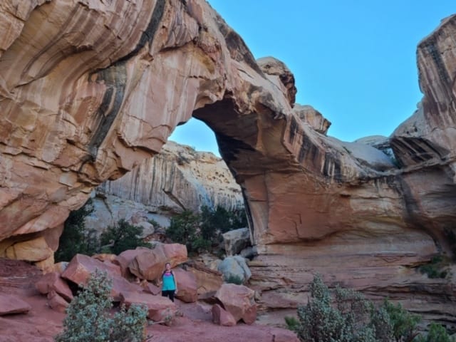
When you leave your Moab hotel this morning, drive to Capitol Reef National Monument located right outside Torrey, Utah. Great hikes for your time in this park are Hickman Bridge Trail (1.8 miles) and Cassidy Arch Trail (3.1 miles). You can also check out Petroglyph Panel and the orchards inside the park. Make sure to be at Sunset Point or Goose’s Overlook when the sun sets for some amazing views.
Day 8: Grand Staircase – Escalante National Monument
The next two days on your Grand Circle Road Trip will be spent exploring Grand Staircase – Escalante National Monument. This is one of the most remote parks in the United States. As such, there are not really any close lodging options. You could stay near Capitol Reef or Bryce Canyon, both of which are about an hour away from Grand Staircase – Escalante. I opted to stay in Torrey and make the drive each day, but do not worry, the drive is beautiful and the time will pass quickly while you are looking at the landscape.
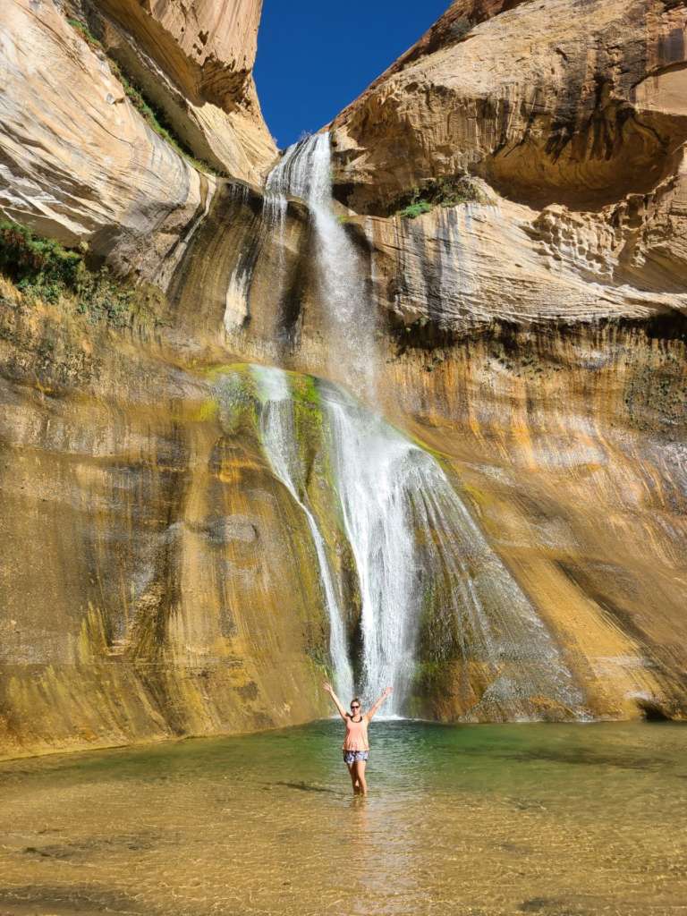
Your only hike for the first day in this park is Lower Calf Creek Falls, which is a 6.7- mile fairly easy trail that leads to a giant waterfall. Be sure to bring your lunch, a swimsuit, and plenty of water. There is little to no tree cover on this hike, and I saw a lot of people suffering from heat exhaustion. So I cannot stress enough to bring lots of water! When you get to the falls, take a dip in the water so you can cool off before hiking back to the parking lot.
Day 9: Grand Staircase – Escalante National Monument
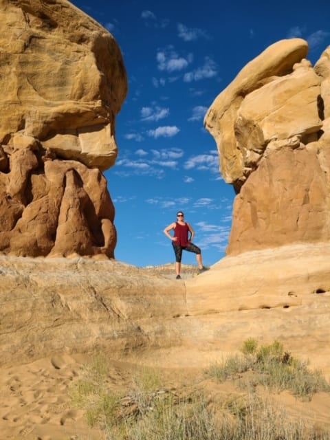
The drive to Grand Staircase – Escalante will be a little longer this morning as you head to Hole in the Rock Road on the other side of the park. The first stop on Hole in the Rock road is Devil’s Garden, which is a small area filled with natural bridges, arches, and hoodoos. We spent about an hour walking around this area and crawling on the structures.
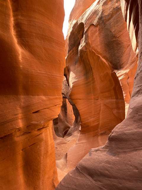
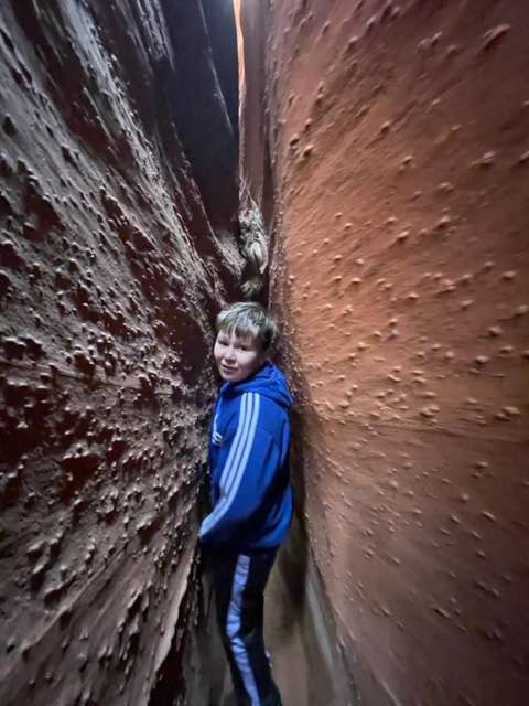
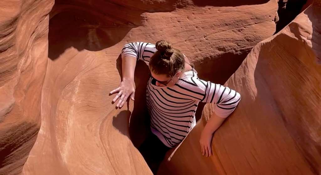
The second stop, which is about 30 miles down Hole in the Rock road, was the Peek-a-boo and Spooky Slot Canyon hike in the Dry Fork area. This hike is a moderately strenuous 4.5-mile hike along a canyon rim, down steep slick rock, up a 12-foot rock wall, and through two slot canyons, with Spooky being barely wide enough to squeeze through. If you get claustrophobic or cannot scale a 12-foot wall, do not attempt these slot canyons.
Both of today’s stops are along a rough, rutted, dirt road, so it is highly recommend to drive a 4×4 vehicle to access this road. We did see regular vehicles driving it, but they were struggling and driving less than 10 mph. After heavy rains, this road is completely impassable even with a 4×4. If you are not traveling with a 4×4 or you do not think you can physically or mentally hike the slot canyons, you can substitute these hikes with the Escalante Natural Bridge Trail, which is 4.4 miles.
Day 10: Bryce Canyon National Park
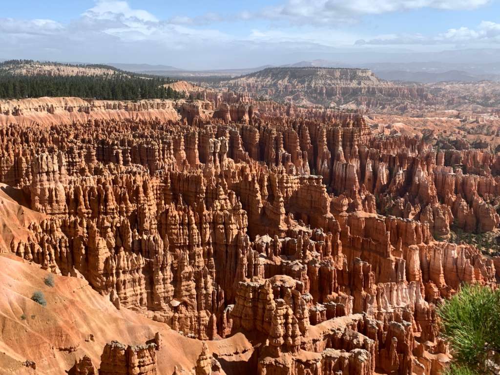
After loading up, we continued our Grand Circle Road Trip to Bryce Canyon National Park. The hoodoos in this park are unbelievable. I had seen pictures of the Bryce Canyon hoodoos before, but none of them did this park justice.
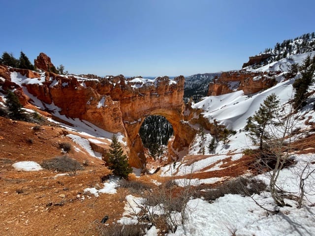
We began the drive at the furthest point, Rainbow Point, which is at an elevation of 9,115 feet. We stopped at all the scenic pullouts before reaching the amphitheater. The Natural Bridge pullout was my favorite until we got to the amphitheater. The road past the amphitheater is closed during winter months and snowy conditions due dangerous road conditions, so make sure to plan your trip around the possible closures.
The amphitheater is the pinnacle of the scenic drive because it is where all the hoodoos are. It is worth stopping at all the stops, but the best view of the hoodoos is at Inspiration Point.
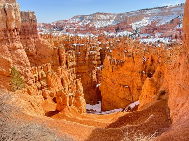
If there is one hike that you do this day, it has to be the 2.9 mile, moderately difficult, Navajo Loop and Queen’s Garden. This trail takes you down into the canyon, and you can walk among the hoodoos. When you are finish your One Day in Bryce Canyon, continue the Grand Circle Road Trip to Springdale, Utah which is the gateway to Zion National Park.
Day 11: Zion National Park
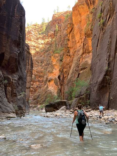
Today’s big event in Zion is the Narrows, which is an epic hike in the Virgin River that carved a narrow canyon. The walk through the ice-cold, flowing river over a bed of rocks makes this hike a strenuous one. We hiked this in water shoes and with hiking poles. If you do not have water shoes and hiking poles, it is highly recommended that you rent water boots and a walking stick from an outfitter. This hike can be up to 9 miles long, depending on how far you go before you turn back. We hiked approximately 5 miles total. Even though this hike is difficult and requires special gear, it is an absolute must-do! This was one of my favorite hikes of the entire Grand Circle Road Trip.
Day 12: Zion National Park
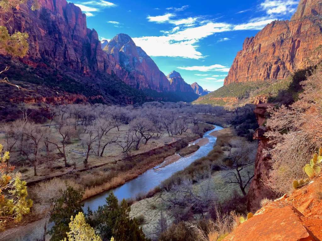
You have a couple options on your second day in Zion. The first is the ultra challenging Angel’s Landing Trail which finishes with plunging cliffs on both sides of the trail, but ends with amazing elevated views of the canyon. However, if this is not your cup of tea (which it is not mine), you can hike the 3-mile Emerald Pools Trails.
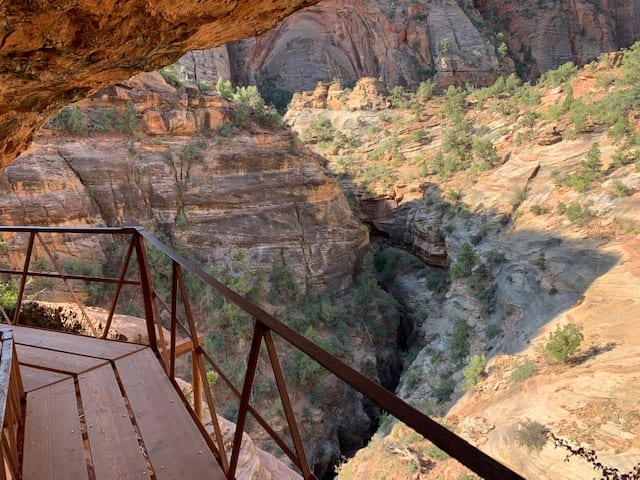
No matter which morning adventure you choose, spend the afternoon on the Mt. Carmel-Zion Scenic Drive. Stop at the Zion Canyon Overlook for a short but exciting trail with an overlook where you can see the hairpin turns of the road below.
Day 13: Valley of Fire State Park
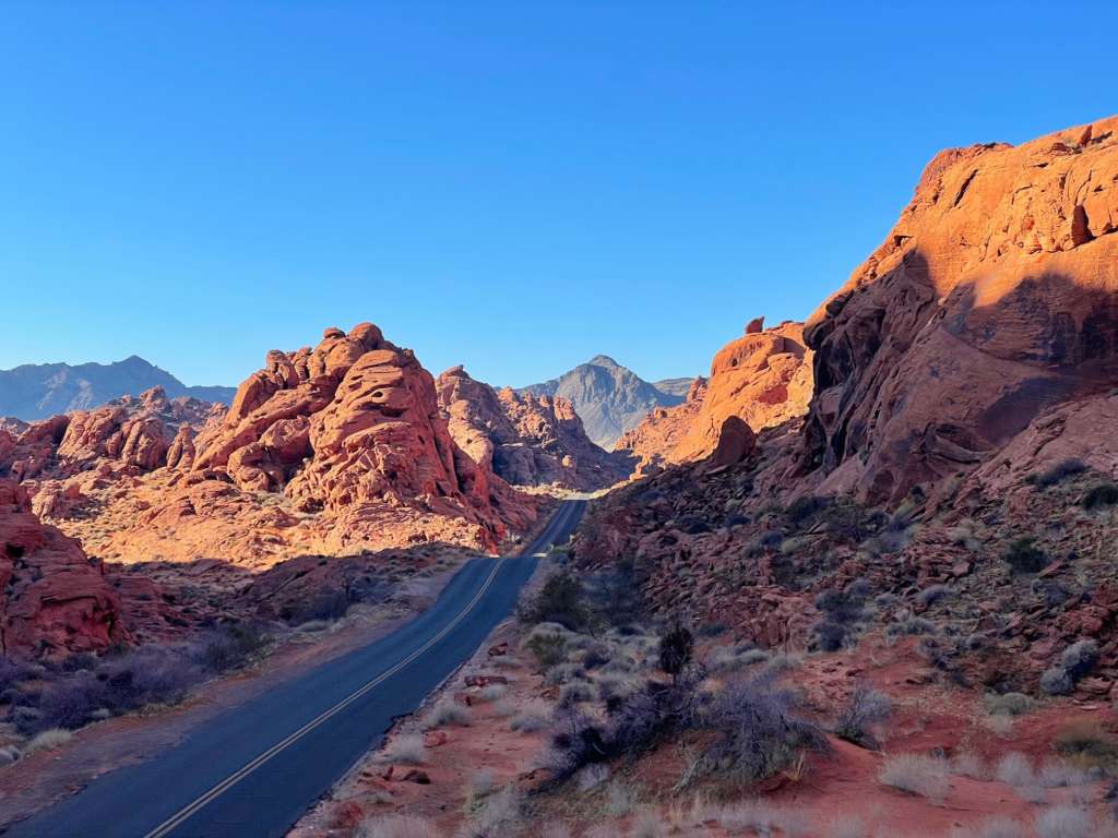
On the Grand Circle Road Trip from Zion National Park to Las Vegas, stop at Nevada’s Valley of Fire State Park for some really interesting and beautiful formations. This park is located just an hour outside of Las Vegas, so it can get crowded with people looking to escape the city. This park offers several short hikes that are perfect for all skill levels as well as beautiful scenic drives.
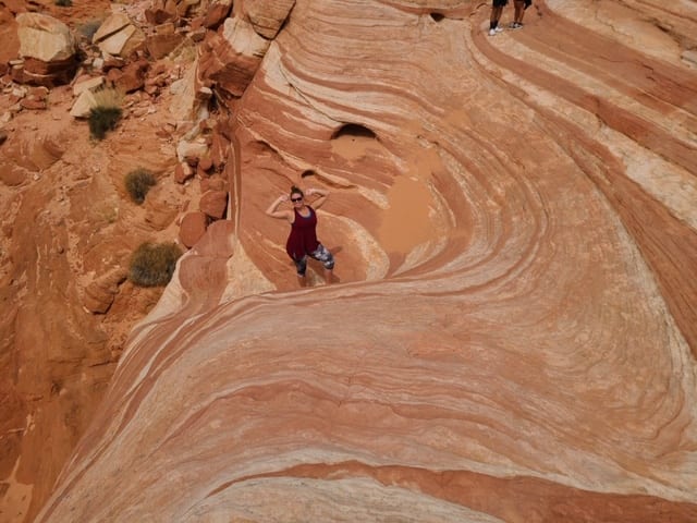
The most popular hike in the park is the Fire Wave which looks very similar to The Wave hike I previously mentioned. However, this hike does not require a lottery permit and is only 1.5 miles in total length making it is a great substitution for The Wave.
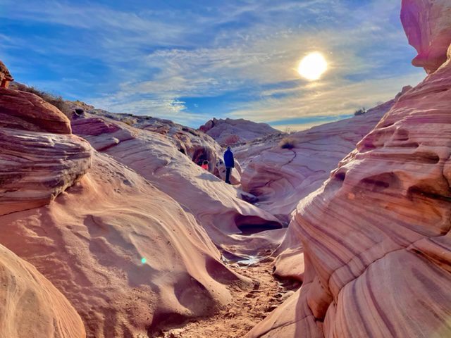
Other hikes you can enjoy include Elephant Rock (0.3 miles), White Domes (1.1 miles), Pastel or Pink Canyon (0.5 miles), Mouse’s Tank Trail (0.8 miles), and Rainbow Vista (1.1 miles). You can also see petroglyphs at Atlatl Rock and climb on the Beehives located near the west entrance. For more about this state park, visit 13 Reasons You Should Visit Valley of Fire. After you get your fill of Valley of Fire, head to Las Vegas for the night.
Day 14: Las Vegas
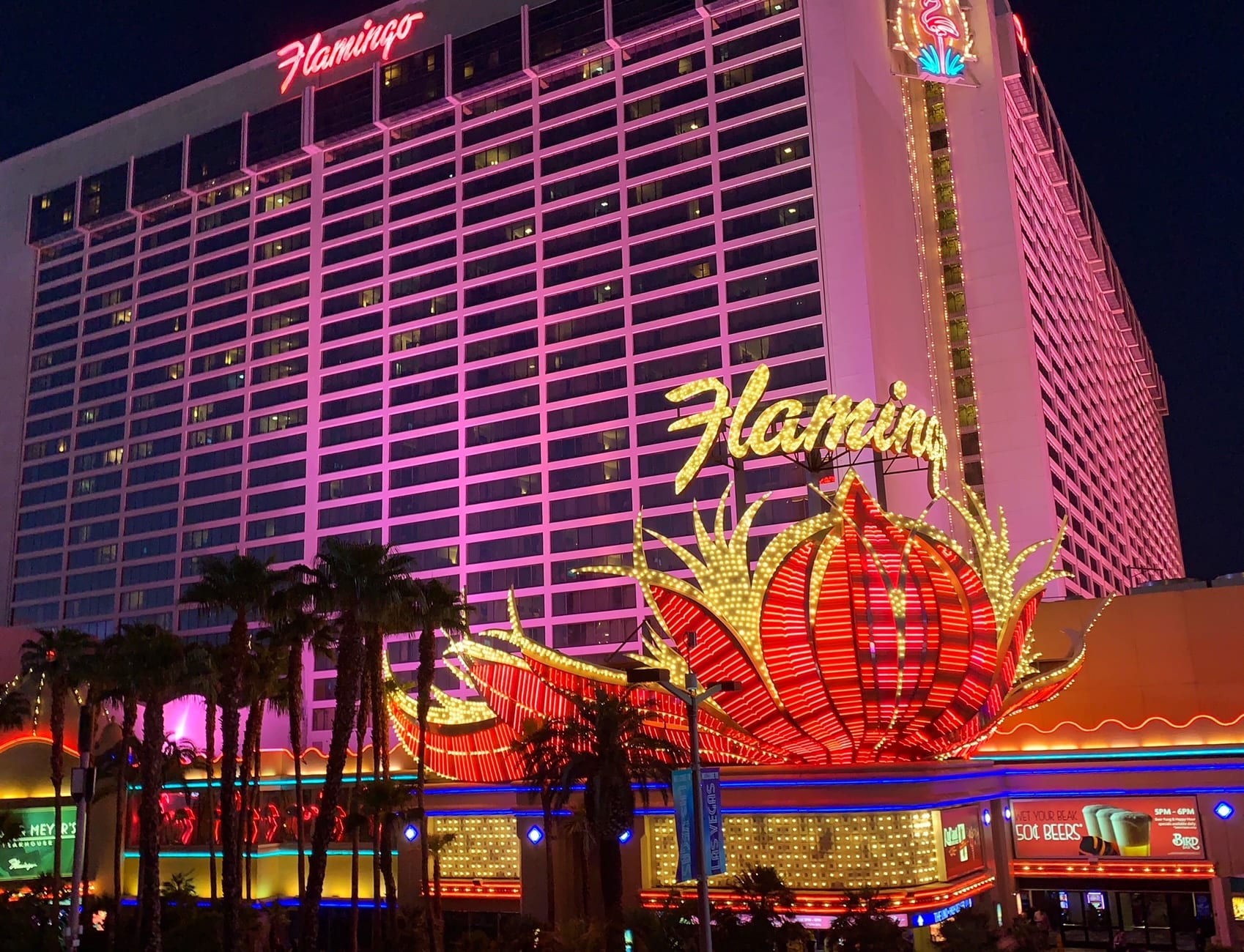
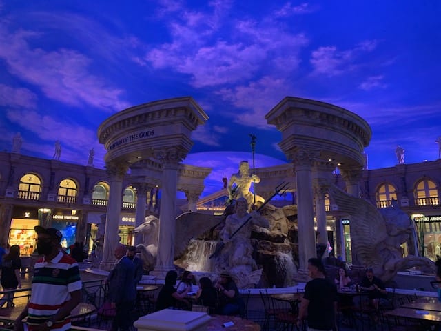
You have completed the Grand Circle Road Trip! Depending on your travel plans, you can either fly out from Las Vegas today or spend the day (or extra days) exploring Sin City. Spend your time walking in and out of the perfectly themed hotels and casinos, eat at amazing restaurants, see a world-class show, or try your luck at gambling. These are just some of the ways you can spend your time in Las Vegas. For first timers, I recommend following this 2-Day Self-Guided Walking Tour of Las Vegas.
You May Also Be Interested In
National Park Road Trips: 10 Incredible 1-Week Itineraries
Arches to Canyonlands: How to Spend One Day
The Perfect Las Vegas Day Trip to Grand Canyon and Hoover Dam
Two-Day Self-Guided Walking Tour of Las Vegas
42 Things to Do for Free in Las Vegas
Discovering Northern Arizona in 4 Days
Valley of the Fire State Park: A Hiker’s Paradise Near Las Vegas
A Whirlwind Utah Road Trip: 6 Parks in 7 Days
9 Comments
Alley Keosheyan
June 13, 2022 12:46 pmThank you so much for linking to our site, http://www.HorseshoeBend.com! FYI, there’s a good alternative hike to The Wave located right in Page, AZ, known as the “New” Wave. No permit, no fees, easy family-friendly hike. Hope you get a chance to come back and try it!
Krystal
June 14, 2022 7:00 amWow! I had no idea! I will definitely check it out! Thank you for commenting!
Comments are closed.