Lower Calf Creek Falls is an amazing waterfall hike in Utah’s Grand Staircase – Escalante National Monument. While this park is very remote, this hike is very popular and can get extremely crowded. The hike is a 6.9-mile, out and back trail. Even though this hike is not a very difficult one, the total length is quite a lot for the average person. Please make sure you are capable of walking this distance and that you are adequately prepared for the heat. I really hope my warnings do not scare you off because this is a wonderful hike that leads to the impressive year-round waterfall, Lower Calf Creek Falls.
Disclaimer: This post may contain affiliate links so if you make a purchase or booking through one of our links we might earn a small commission (but don’t worry, it is no extra cost to you).
How to Get to Lower Calf Creek Falls
Lower Calf Creek Falls trailhead is located near the Calf Creek Campground inside Grand Staircase – Escalante National Monument in Utah. The trail is on the beautiful Highway 12 Scenic Byway about halfway between Bryce Canyon and Capitol Reef National Parks. The parking lot only holds around 30 vehicles, and the overflow parking is along the main highway. Parking along the highway will add a little bit of walking distance to your overall hike. To avoid this, I would recommend arriving early.
When to Visit Lower Calf Creek Falls
The best time of year to visit Grand Staircase – Escalante is March through June and September through October. The summer months are far too hot to hike this trail. And the shoulder months will still be warm enough to enjoy the cool waters at the base of the waterfall.
Entrance Fee for Lower Calf Creek Falls
A day pass for Lower Calf Creek Falls is $5 and can be paid via the self-paid envelopes in the parking lot. Make sure to bring cash and exact change as there is not an attendance on site. If you have an America the Beautiful park pass, which will allow you into all national parks for a year for one single fee, you can display the pass on your dash or from your rearview mirror. Also, if you have a 4th grader in your household, you can get a family pass for free to the national parks that is good for a year. Find out more about that benefit here.
What to Pack for Lower Calf Creek Falls
- Water!! Whether you use a hydration backpack or carry bottled water, make sure to pack plenty of water when outdoors!
- Sunscreen – Protect your skin from the sun, and do not forget to reapply.
- Hat – More sun protection to block the sun from your face
- Microfiber Tower – These towels fold up to practically nothing and will dry you off after taking a dip at the waterfall.
- Cooling Towel – Wet these towels and put around your neck to keep your body from overheating.
- Hiking shoes/boots – Some of the hikes are on steep, slick rock, and people wearing regular tennis shoes struggled to keep their footing. Here are the men‘s version of the hiking shoes I love.
- Hiking socks – The best way to prevent blisters is by keeping your feet dry. Moisture-wicking socks are the best way to do that.
- Water Shoes – If you want to get in the water, you may want water shoes. I just went barefoot though.
- Hiking Poles – Hiking poles can help ease the difficulties of ascending and descending slopes.
- Backpack – A backpack is a necessity when hiking to carry your water, snacks, sunscreen, etc. that you may need on your longer hikes.
- RTIC Soft-Sided Cooler – Keep your drinks and packed lunch cool in this cooler.
- Printed Maps/Directions – Cell service is spotty, so I recommend you print maps/directions or download offline maps to all hiking trails and parks you plan to visit.
Tips for Hiking Lower Calf Creek Falls
- Leave no trace. Make sure to pack out whatever you packed in.
- There is little to no tree cover or shade, so it is easy to get overheated. Make sure to protect yourself. I saw several people struggling with the heat because they did not prepare properly. One small child had to be carried out because of her heat exhaustion.
- Bring plenty of water with you, and do not drink the creek water.
- There are no restroom facilities along the trail, so make sure to go in the restrooms at the parking area.
- Wear waterproof sunscreen if you are swimming in the creek to avoid water contamination and to protect the ecosystem.
Interpretive Stops on Lower Calf Creek Falls
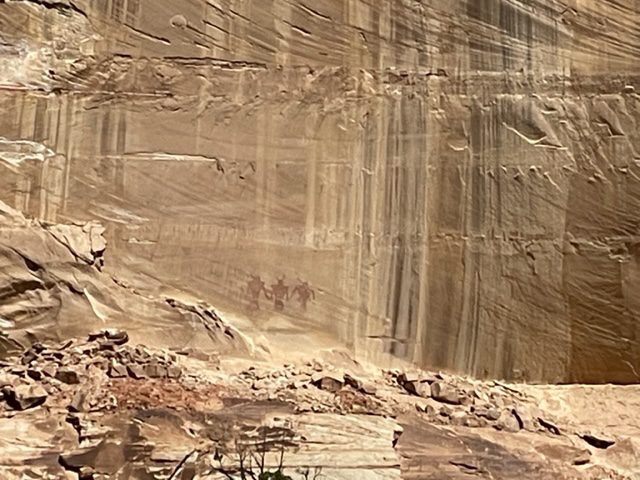
When I hiked Lower Calf Creek Falls, I noticed there were several number markers along the trail, and I did not know what they were for. Another hiker informed me these were interpretive stops marking sights for you to see. Because I did not know about these, I missed out. But I do not want you to miss out! So print this list and keep a look out for the markers.
- This is Calf Creek, and it flows year-round.
- Through water erosion from the creek and flash floods, the canyon was formed.
- Beaver dams are part of the ecosystem, and they create ponds and marshy areas for insects, frogs, and birds to flourish.
- Look for Gambel Oak.
- In the early 1900s, a local farmer had a watermelon farm here.
- Look high on the cliff across from the creek to see a food and seed storage structure built over 800 years ago by prehistoric peoples.
- The sandstone cliffs are what remains from a once desert that was here millions of years ago.
- The old fence line is from where pioneers kept calves and where Calf Creek got its name.
- Look at the canyon across the creek, towards the bottom where the cliff is smooth. There is a pictograph of 3 large figures in red.
- On the right canyon wall, look for another storage structure.
- Horsetail is a plant that is only found in wet, marshy lands and can grow to a height of 50 feet.
- Because of the vegetation, this is a great place to bird watch. You can see hummingbirds, ravens, peregrine falcons, and American robins.
- You can often see brook, brown, and rainbow trout in the creek.
- The banks of the creek are reinforced with cattail, common reed, river birch, cottonwood, and willows.
- The mist of Lower Calf Creek Falls keeps this area cool.
What to Expect Along the Trail
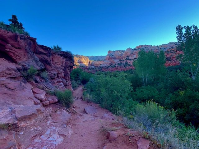
Begin the trail early to avoid massive crowds. We arrived around 7:45 am, and there were only a few cars in the parking lot. But by the time we left, the parking was a mess from so many vehicles. Starting early also means you can hike for a while in the shade before the sun ascends over the canyon walls.
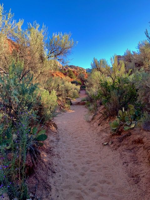
There is a little bit of rock scrambling, but a huge part of this trail is sand which can be tough walking in. I wore waterproof hiking shoes which doubled as sand-proof shoes. It was nice not having sand in my shoes because the fine particles could not penetrate my waterproof shoes. If you are hiking to Lower Calf Creek Falls in the summer or early fall, expect a lot of vegetation that grows into the path.
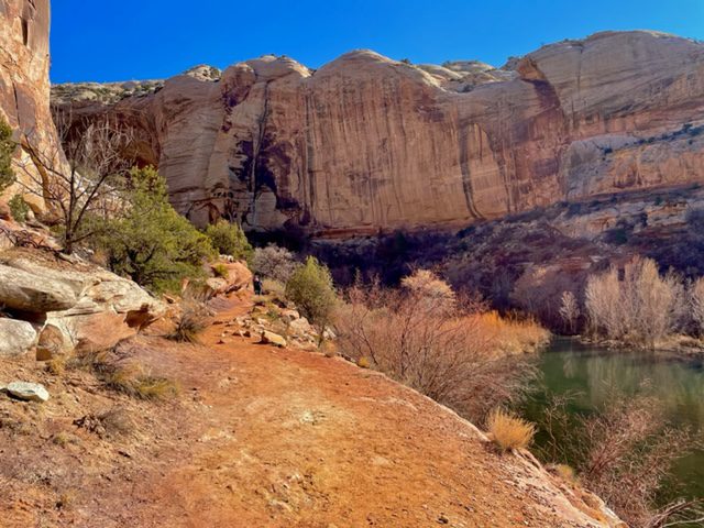
About 2.0 miles into the hike, the trail take a short, steep descent and then turns to the right. You will walk between a peak and a wide part in Calf Creek before turning left where the canyon narrows.

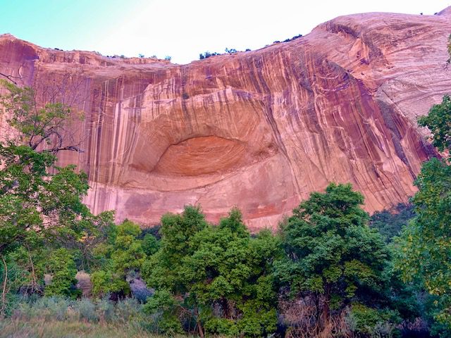
As the canyon narrows, you can get closer views of the canyon wall across the creek. See the stains from water falling over the cliffs for millions of years. You can also see the beginning of an arch forming from erosion.

For most of the rest of the trail, you will be walking next to the marsh lands created by the creek. You can see several of the plant varieties mentioned in Interpretive Stop #14.
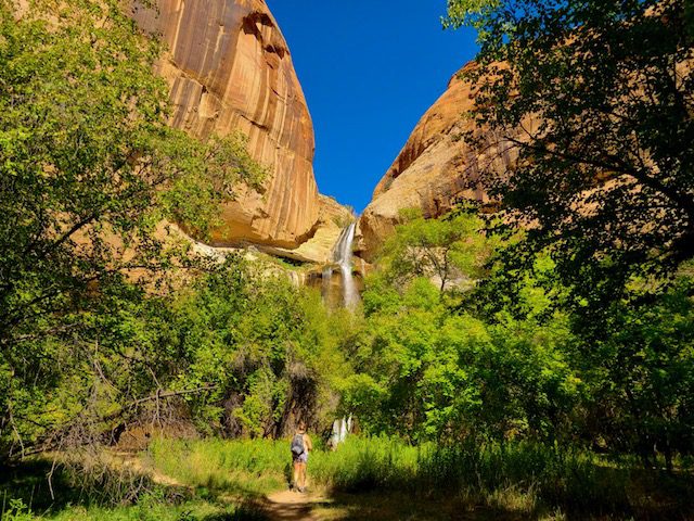
As you near Lower Calf Creek Falls, you can see the top of the waterfall pouring over the canyon wall ahead. This area has several tall trees you can use for shade.

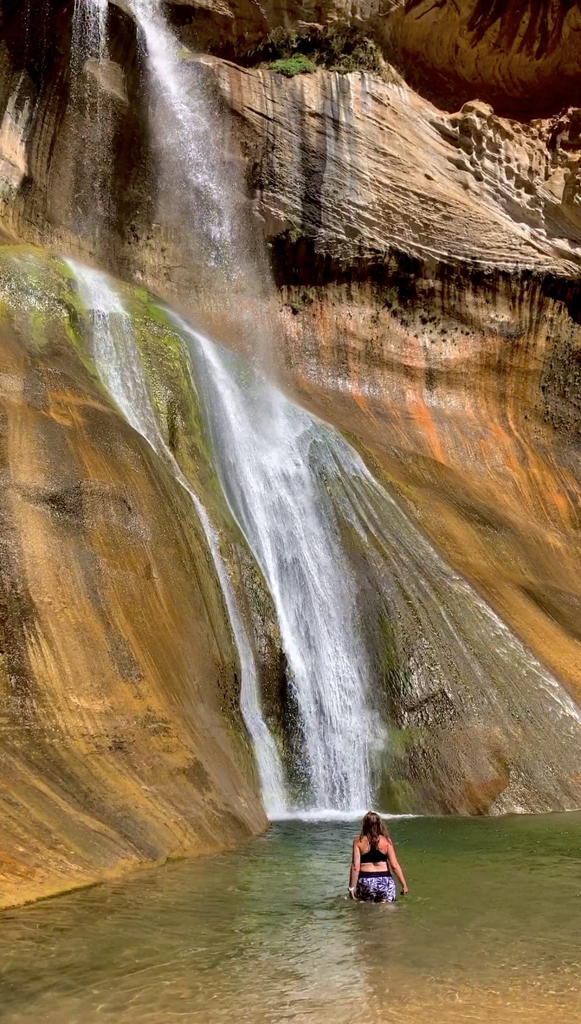
You have arrived! At the base of the waterfall, have a seat on a towel and marvel at the 130-foot waterfall that cascades down the cliff wall into a shallow green pool. The water is cold, clear, and perfect to take a dip in to cool off. Also, bring a packed lunch and enjoy a picnic here before walking back to the parking area.
Upper Calf Creek Falls Trail
If you are looking for another trail to hike in this area, try the Upper Calf Creek Falls Trail. This trail takes you to a viewing area where you can see Upper Calf Creek Falls which is 88-feet tall. You can swim at this waterfall as well, and it is usually less crowded than the more popular lower falls. This trail is 2.1-mile, out and back and gains 606 feet in elevation. This trail is mostly along slick rock and is marked by cairns.
You May Also Be Interested In
The Ultimate 2-Week Grand Circle Road Trip


1 Comment
Comments are closed.