The Columbia River Gorge National Scenic Area of Oregon is one of the most beautiful spots in America, and it is my favorite place to hike. Waterfalls, lush forests, and gorges….what’s not to love! The great part is the best hikes in Columbia River Gorge range from less than half a mile to several miles, so there are trails for people of all skill levels.
Disclaimer: This post may contain affiliate links so if you make a purchase or booking through one of our links we might earn a small commission (but don’t worry, it’s no extra cost to you).
How to Get Here
The best hikes in Columbia River Gorge are located rather close to Portland, Oregon which makes them very easy to access. However, this is one of the reasons why this area is so popular and crowded. To get to the Columbia River Gorge from Portland, take I-84E/US-30E. You can drive on the highway as much as you want, or you can take the scenic drive on the Historic Columbia River Highway, which you can access starting from Troutdale.
When to Visit
The best time to visit the best hikes in Columbia River Gorge is April to June and September through October when crowds are not quite as busy as the summer. July and August are the best times to visit for sunny days if you do not mind the crowds. April to June can be very wet and rainy, but it is also wildflower season which adds to the beauty of this area. Because of its close proximity to Portland, any weekend will be flooded with locals getting out of the city for a couple days.
Where to Stay
If you prefer to stay in the big city, you can always stay in Portland and drive to the Columbia River Gorge area during your visit. The trailheads range from 30 minutes to a little over an hour drive from Portland. However, if you want to get out of the city and get a little closer to the trails, you can stay in one of several small towns such as Troutdale, Cascade Locks, and Hood River. Hood River is a town that has lots of fun things to do, so I recommend staying in this town. See all the fun things to do in Hood River here.
Entrance Fees
Some of the trails require a day pass of $5 which can be paid with cash at the trailhead. There are no attendants at the trails, so you will need to bring exact change. If you have a NW Forest Pass, or a National Park Interagency Pass, you can display your permit on your dash and not pay the daily fee.
The Columbia River Gorge Waterfall Corridor has become so popular that there is now a timed access permit required if you are visiting from the end of May to the beginning of September from 9am to 6pm. You can get your permits here. You can also choose to experience the waterfalls in the area via the hop-on/hop-off Waterfall Trolley or other operating shuttles.
What to Pack
- Water!! Whether you use a hydration backpack or carry bottled water, make sure to pack plenty of water when outdoors!
- Bug Spray – Keep those pesky bugs away!
- Sunscreen – Protect your skin from the sun, and do not forget to reapply.
- Hat – More sun protection to block the sun from your face
- Hiking shoes/boots – Here are the men‘s version of the hiking shoes I love.
- Hiking socks – The best way to prevent blisters is by keeping your feet dry. Moisture-wicking socks are the best way to do that.
- Backpack – A backpack is a necessity when hiking to carry your water, snacks, sunscreen, etc. that you may need on your longer hikes.
- Hiking Poles – Hiking poles help relieve some of the energy used by your legs when hiking.
- RTIC Soft-Sided Cooler – Keep your drinks cool (or sandwich stuff if you are on a budget) in this easy to pack cooler.
- Packing Cubes – Keep your stuff organized in your luggage with these packing cubes.
- Rain Jacket – Rain can (and probably will) occur at some point while in Oregon, so make sure to pack your men’s or women’s rain jacket.
- Jacket – Even in warmer months, the temps can be cool so pack a light men’s or women’s jacket.
Best Hikes in Columbia River Gorge
1. Multnomah Falls
- Trail Length – 2.4 miles
- Elevation Gain – 810 feet
- Difficulty Rating – Moderate
- Route Type – Out and back
- Parking Situation – The parking lot holds 186 cars but you must have a timed entry permit if visiting from late May to early September. Shuttles are an option.
- Restroom Situation – There are restrooms in the lodge and gift shop area.
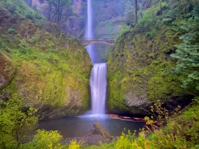
Multnomah Falls is an iconic waterfall and is Oregon’s tallest at 620 feet. Views from the base of this waterfall are located just a short walk from the parking lot. Benson Bridge crosses Multnomah Creek and is only a 0.2 mile walk from the base of the falls. However, if you want to reach the top of Multnomah Falls, you will need to walk another mile up the 11 switchbacks. You can expect heavy crowds at this waterfall year round, so I recommend arriving early to avoid gobs of people.
2. Oneonta Gorge

- Trail Length – 1.0 miles
- Elevation Gain – 30 feet
- Difficulty Rating – Moderate
- Route Type – Out and back
- Parking Situation – There is a small parking lot that can hold 15-20 cars.
- Restroom Situation – There are no restrooms.
**This trail is currently closed due to the 2017 Eagle Creek Fire.** While short, this hike is one of the best hikes in Columbia River Gorge because of its adventurous nature. The trail is literally a creek that you walk in between two moss-covered gorge walls and ends at Oneonta Falls. Depending on the time of year you visit, the waters can get chest deep so dress appropriately. I still have not mentioned the most adventurous part of the hike: the log jam. There is a giant log jam that you have to scale towards the beginning of the trail. This can be dangerous so continue with caution.
3. LaTourell Falls Loop

- Trail Length – 2.0 miles
- Elevation Gain – 639 feet
- Difficulty Rating – Moderate
- Route Type – Loop
- Parking Situation – The parking area fits approximately 50 cars with additional parking on the side of the road.
- Restroom Situation – There are 2 pit toilets
LaTourell Falls is an incredible waterfall that you can see from two spots, both of which are short walks from the parking lot. The first is from a viewing platform, and the second is from the base of the falls. However, if you want to hike the full 3.0-mile loop you can also see Upper LaTourell Falls. Most people stop at the first waterfall, so you can virtually have the trail to yourself if you complete the loop.
4. Wahkeena Falls Loop Trail
- Trail Length – 6.1 miles
- Elevation Gain – 1,751 feet
- Difficulty Rating – Moderate
- Route Type – Loop
- Parking Situation – You can begin this loop at the Multnomah parking area or the Wahkeena Falls parking area, which holds approximately 30 cars.
- Restroom Situation – There are restrooms in the Multnomah Lodge and gift shop area.
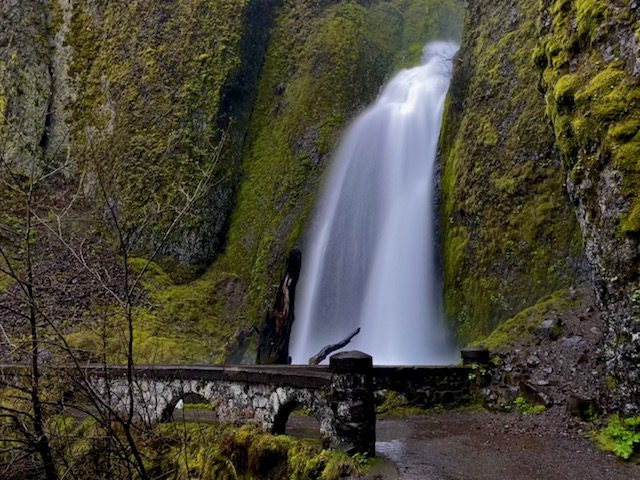
Wahkeena Falls Loop Trail can be started from the Multnomah Falls or Wahkeena Falls parking areas. If parking is available, I recommend starting at Multnomah Falls and hike up the switchbacks to the top of the waterfall. This part of the trail is the Multnomah Trail and most people turn back at this point. But you will continue walking along Multnomah Creek to complete the loop. This trail takes you by several waterfalls on your way to Wahkeena Falls including Fairy Falls, Ecola Falls, and Weisendanger Falls.
5. Dog Mountain
- Trail Length – 6.5 miles
- Elevation Gain – 2,988 feet
- Difficulty Rating – Strenuous
- Route Type – Out and back
- Parking Situation – The parking lot holds around 80 vehicles
- Restroom Situation – There are pit toilets located about 0.1 miles up the trail.
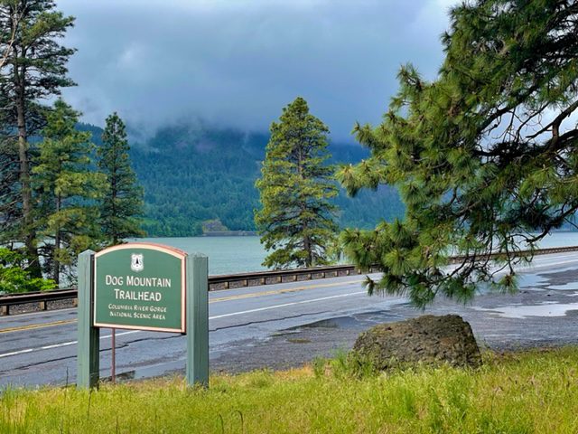
If you are looking for a strenuous hike that will get your heart racing, give Dog Mountain a try. This trail starts with steep switchbacks and has great views of the Columbia River Gorge from atop a mountain. This trail is so popular during wildflower season that it requires a permit on the weekends and Memorial Day. Also, it is important to note that this trail is on the Washington side of the Columbia River so bring cash to cross one of the toll bridges.
6. Catherine Creek Arch Loop

- Trail Length – 1.9 miles
- Elevation Gain – 383 feet
- Difficulty Rating – Easy
- Route Type – Loop
- Parking Situation – The parking lot holds approximately 50 vehicles
- Restroom Situation – There are porta-potties across the street from the parking lot.
Catherine Creek Arch Loop is another trail on the Washington side of the river and is also popular during wildflower season. As you reach the top of the hill, you will see meadows full of wildflowers with the Columbia River and Mt. Hood as the backdrop. The trail loops around and travels down into a ravine where you have an easy stroll to finish the hike.
7. Dry Creek Falls via PCT
- Trail Length – 4.4 miles
- Elevation Gain – 885 feet
- Difficulty Rating – Moderate
- Route Type – Out and back
- Parking Situation – You can park at the Toll Bridge Park where there are 5-8 parking spots, or you can park at the Pacific Crest Trailhead where there are around 20 parking spots.
- Restroom Situation – There are restrooms at the Toll Bridge Park.
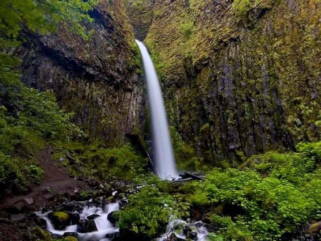
Dry Creek Falls is located on a short spur off the Pacific Crest Trail and starts at Toll Bridge Park at the Bridge of the Gods. Even though this hike is a little over 4 miles, it is not a difficult trek. The trail is a steady incline through a dense, green forest. At the 2 mile mark, you will reach an intersection where you will turn right to take the spur to Dry Creek Falls. Upon approaching the waterfall, you can cross the narrow concrete bridge to cross the creek and get closer to the base of the falls. For more details on how to hike this trail, see How to Hike Dry Creek Falls via PCT.
8. Eagle Creek to Punchbowl Falls
- Trail Length – 4.7 miles
- Elevation Gain – 1,046 feet
- Difficulty Rating – Moderate
- Route Type – Out and back
- Parking Situation – The parking lot holds approximately 40 vehicles.
- Restroom Situation – There are restrooms in the parking area.
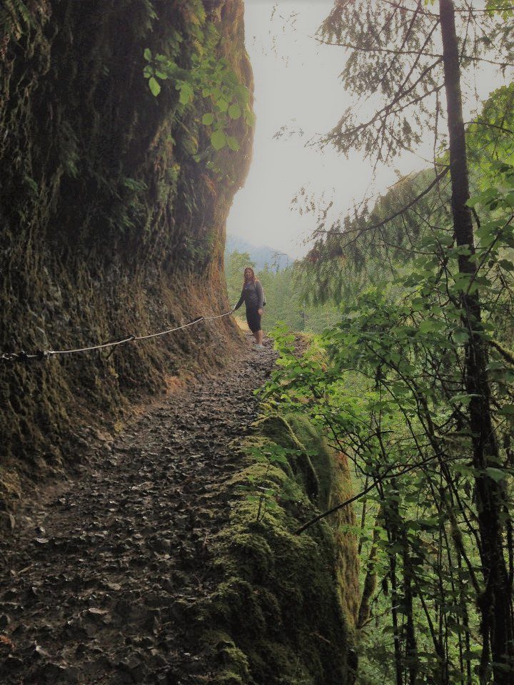
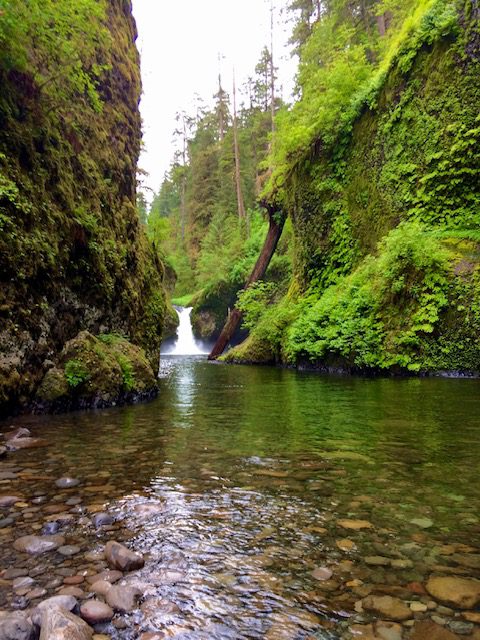
Eagle Creek to Punchbowl Falls is one of the best hikes in Columbia River Gorge, not only for the several waterfalls you can see along the way but also for semi-dangerous trail on the edge of a cliff. Do not attempt this hike if you are afraid of heights and steep drop-offs. Parts of this trail are carved out of a tall cliff and have chains anchored into the cliff walls that you can hold onto. The end of this route is Punchbowl Falls which you can see better after walking out onto rocks in the creek.
9. Horsetail Falls and Ponytail Falls
- Trail Length – 0.9 miles
- Elevation Gain – 331 feet
- Difficulty Rating – Easy
- Route Type – Out and back
- Parking Situation – The parking lot holds approximately 40 cars.
- Restroom Situation – There no restrooms in this area.
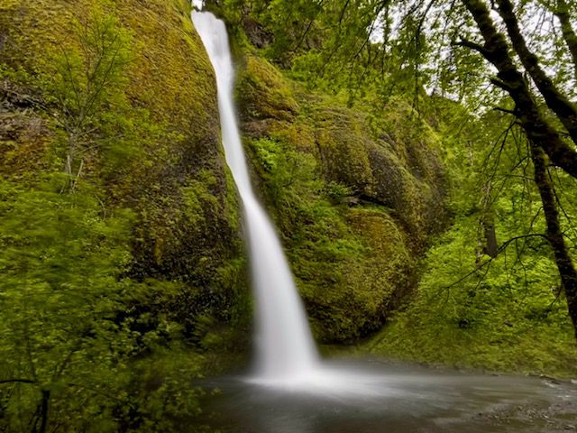
Horsetail Falls can actually be seen without any hiking as it is located roadside, so this waterfall gets extremely crowded. Do not make the mistake of stopping here though. Walk the trail to the top of Horsetail Falls and continue a bit until you get to Ponytail Falls. This is one of the few waterfalls in the area that you can walk behind. If you decide to walk even further, you can see Oneonta Falls after you walk down a few switchbacks and cross the bridge over Oneonta Gorge.
10. Bridal Veil Falls
- Trail Length – 0.5 miles
- Elevation Gain – 78 feet
- Difficulty Rating – Easy
- Route Type – Out and back
- Parking Situation – The parking lot officially holds around 20 vehicles but cars park along the road and grassy areas when busy.
- Restroom Situation – Nice restrooms are available here.
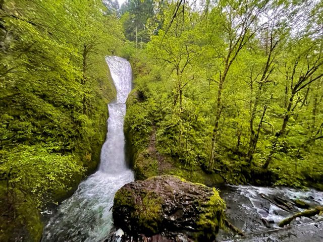
The trail to Bridal Veil Falls is one of the shortest and best hikes in Columbia River Gorge. The trail takes you down a fairly steep decline and one switchback before you cross the bridge over Bridal Veil Creek. Then you will climb a few steps to the viewing platform and can watch as the double waterfall plunges into the creek below.
11. Wahclella Falls
- Trail Length – 1.9 miles
- Elevation Gain – 223 feet
- Difficulty Rating – Easy
- Route Type – Out and back
- Parking Situation – The parking lot holds approximately 10-12 vehicles.
- Restroom Situation – There are porta-potties in the parking area.
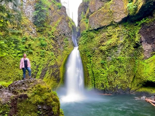
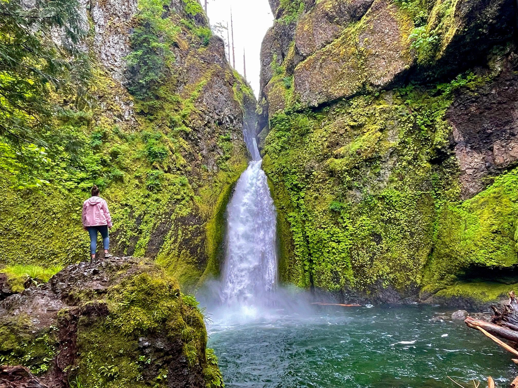
Wahclella Falls is my all time favorite waterfall hike in the Columbia River Gorge area which is saying a lot because all the waterfalls here are breathtaking. This hike starts along a creek laced with wildflowers. As you near the waterfall, you cross a bridge and see a ton of giant, moss-covered boulders. The waterfall itself is a powerful rush of water through a small opening into a turquoise pool making it truly a sight to see. This entire hike looks like something straight out of a fairytale.
12. Elowah and Upper McCord Falls Trail
- Trail Length – 2.4 miles
- Elevation Gain – 862 feet
- Difficulty Rating – Moderate
- Route Type – Out and back
- Parking Situation – The parking lot holds approximately 20 vehicles.
- Restroom Situation – There are restrooms in the parking area.
Unfortunately, this trail was closed during my visit due to a recent landslide, so I was unable to hike it. Even though I was not able to hike this trail for myself, I am confident it is one of the best hikes in Columbia River Gorge. This short hike takes you to two waterfalls: Elowah Falls and Upper McCord Falls. Elowah Falls can actually be seen for a split second from the highway as you pass McCord Creek, and it looks spectacular.
You May Also Be Interested In:
The 18 Best Things to Do in Hood River, Oregon
The Greatest Oregon Road Trip: See the Best of Oregon’s Natural Wonders in 14 Days
How to Spend 3 Days in Columbia River Gorge Oregon
The Best Day Trips from Portland, Oregon
The 20 Best Waterfalls in Oregon
How to Hike Oregon’s Trail of Ten Falls


6 Comments
Comments are closed.